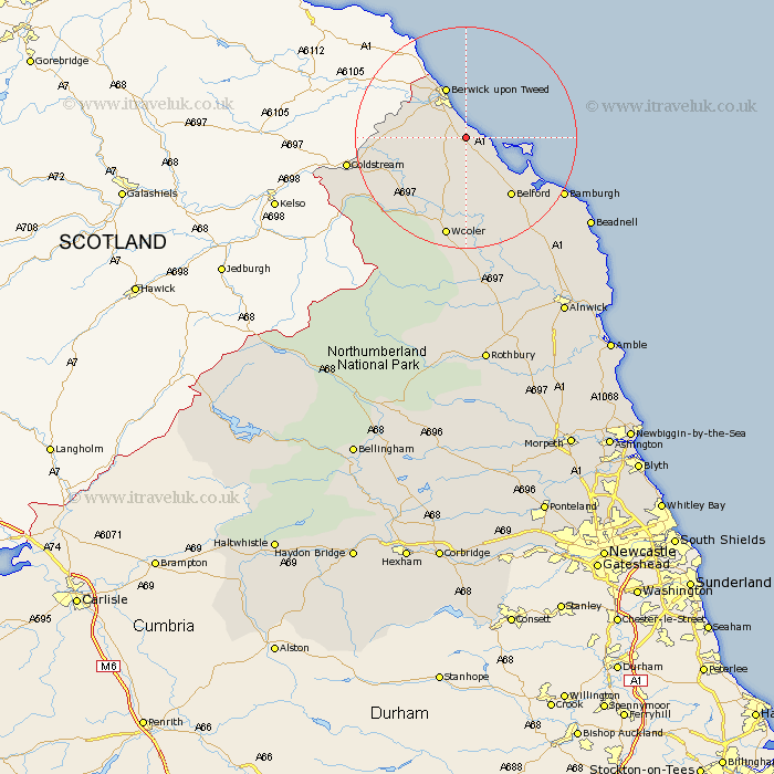
Northumberland Map Showing Location of Cheswick
District: Berwick-upon-Tweed
Easting: 403142 Northing: 645171
Latitude: 55.7 Longitude: -1.95
 = Cheswick
Easting: 403142 Northing: 645171
Latitude: 55.7 Longitude: -1.95
= Cheswick
This Cheswick map below is supplied by Google. Use the tools in the top left corner to zoom into street level or zoom out for a road map, you may also need to zoom in to see Cheswick on the map. Click and drag the map to move around. If the map fails to load try and refresh your browser or zoom in or out (+ or -).
Update - it seems Google no longer allow people to use their maps for free! This Cheswick map sometimes loads and sometimes gives a error. I am working on a solution.
Closest 30 Towns or Cities to Cheswick (Population over 500)
Ancroft 3.13km East Ord 6.95km Ord 6.95km Lowick 7.49km Berwick-on-Tweed 9.78km Berwick-upon-Tweed 9.78km Berwick 9.78km Berwick on Tweed 9.78km Berwick-Upon-Tweed 9.78km Berwick upon Tweed 9.78km Norham 12.67km Belford 13.31km Wooler 18.8km North Sunderland 23.15km Beadnell 25.95km Embleton 31.93km Almwick 36.88km Alnwick 36.88km Alnmouth 39.97km Shilbottle 40.68km Lisburg 40.99km Lesbury 40.99km Rothbury 42.74km Warkworth 44.21km Swarland 46.52km Amble 46.86km Longframlington 47.51km Felton 48.94km Thirston 49.29km East Thirston 49.29km