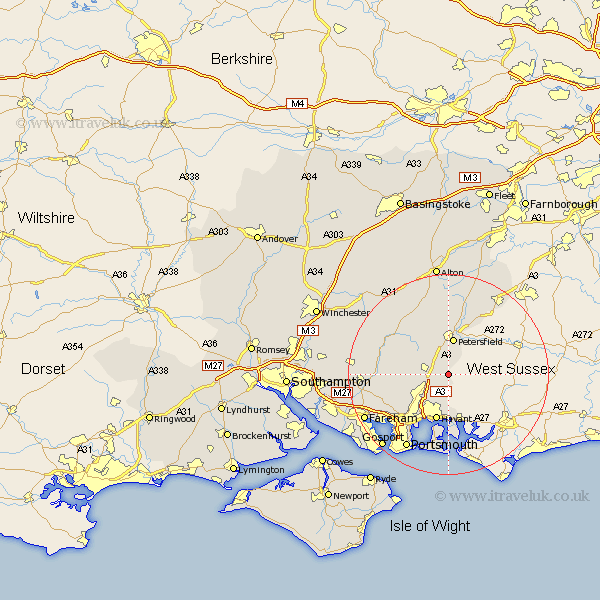
Hampshire Map Showing Location of Chalton
District: East Hampshire
Easting: 473775 Northing: 115458
Latitude: 50.93 Longitude: -0.95
 = Chalton
Easting: 473775 Northing: 115458
Latitude: 50.93 Longitude: -0.95
= Chalton
This Chalton map below is supplied by Google. Use the tools in the top left corner to zoom into street level or zoom out for a road map, you may also need to zoom in to see Chalton on the map. Click and drag the map to move around. If the map fails to load try and refresh your browser or zoom in or out (+ or -).
Update - it seems Google no longer allow people to use their maps for free! This Chalton map sometimes loads and sometimes gives a error. I am working on a solution.
Closest 30 Towns or Cities to Chalton (Population over 500)
Horndean 2.98km Clanfield 3.5km Buriton 3.71km Rowlands Castle 5.56km Petersfield 7.51km East Meon 8.06km Hambledon 8.38km Waterlooville 8.76km Waterloo 8.76km Emsworth 9.34km Steep 9.35km Havant 9.55km Froxfield 9.91km Liss 11.66km Soberton 12.85km Droxford 12.98km West Meon 13.16km Corhampton 13.37km Greatham 13.44km Southwick 13.84km Swanmore 15.18km Wickham 15.63km Bramdean 16.12km Portchester 16.14km Porchester 16.14km Shedfield 16.46km Shidfield 16.46km Selborne 16.72km Portsmouth 17.21km Ropley 17.52km