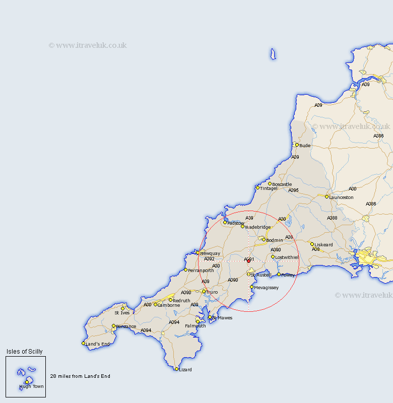
Cornwall Map Showing Location of Bugle
Population: 2646
Area Size (ha): 82
District: Restormel
Easting: 200965 Northing: 57527
Latitude: 50.38 Longitude: -4.8
 = Bugle
Area Size (ha): 82
District: Restormel
Easting: 200965 Northing: 57527
Latitude: 50.38 Longitude: -4.8
= Bugle
This Bugle map below is supplied by Google. Use the tools in the top left corner to zoom into street level or zoom out for a road map, you may also need to zoom in to see Bugle on the map. Click and drag the map to move around. If the map fails to load try and refresh your browser or zoom in or out (+ or -).
Update - it seems Google no longer allow people to use their maps for free! This Bugle map sometimes loads and sometimes gives a error. I am working on a solution.
Closest 30 Towns or Cities to Bugle (Population over 500)
Stenalees 0.47km Roche 3.01km St. Austell 5.56km Saint Austell 5.56km St Austell 5.56km St. Dennis 5.91km Saint Dennis 5.91km St. Denis 5.91km St Dennis 5.91km St Denis 5.91km Saint Denis 5.91km St Blazey 6.19km St. Blazey 6.19km Saint Blazey 6.19km Par 6.98km Lanivet 7.78km Saint Stephen 9.01km St Stephen 9.01km St. Stephen 9.01km Tywardreath 9.07km Lostwithiel 9.63km Saint Columb 10.96km St. Columb Major 10.96km St Columb Major 10.96km St. Columb 10.96km Saint Columb Major 10.96km St Columb 10.96km Bodmin 10.99km Mevegissey 11.18km Mevagissey 11.18km