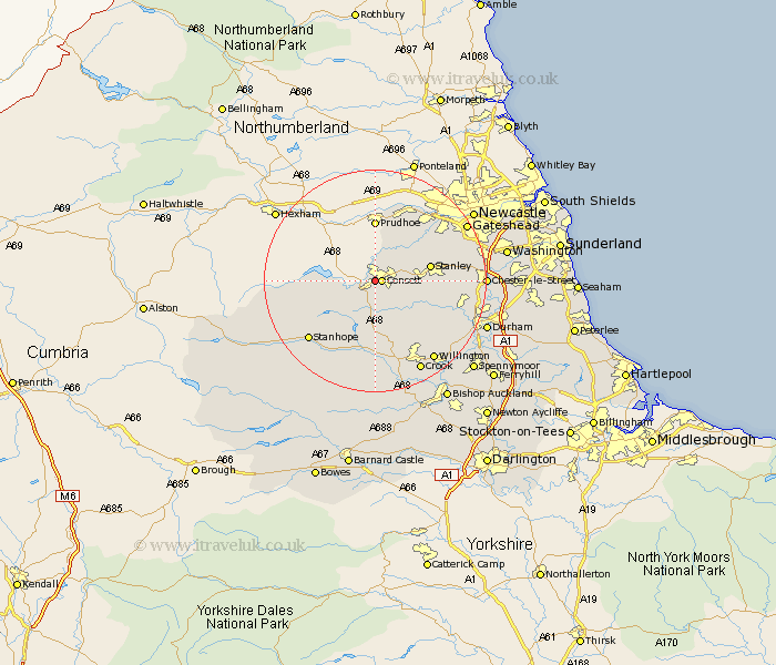
Durham Map Showing Location of Black Hill
District: Derwentside
Easting: 409630 Northing: 550597
Latitude: 54.85 Longitude: -1.85
 = Black Hill
Easting: 409630 Northing: 550597
Latitude: 54.85 Longitude: -1.85
= Black Hill
This Black Hill map below is supplied by Google. Use the tools in the top left corner to zoom into street level or zoom out for a road map, you may also need to zoom in to see Black Hill on the map. Click and drag the map to move around. If the map fails to load try and refresh your browser or zoom in or out (+ or -).
Update - it seems Google no longer allow people to use their maps for free! This Black Hill map sometimes loads and sometimes gives a error. I am working on a solution.
Closest 30 Towns or Cities to Black Hill (Population over 500)
Consett 1.07km Consetti 1.07km Castleside 2.14km Leadgate 3.7km Annfield Plain 7.47km Lanchester 8.34km Cornsay 9.14km Stanley 9.38km Burnopfield 10.18km Rowlands Gill 10.52km Esh 12.14km Langley Park 12.99km Tow Law 13.15km Edmondsley 13.87km Whickham 14.12km Ushaw Moor 14.81km Witton Gilbert 14.95km Wolsingham 14.98km Sacriston 15.4km Stanhope 15.42km Ouston 15.94km Ouston Moor 15.94km Pelton 16.11km Blaydon 16.13km Lamesley 17.63km Willington 17.67km Chester-le-Street 18.14km Gateshead 18.24km Gateshead on Tyne 18.24km Gateshead-on-Tyne 18.24km