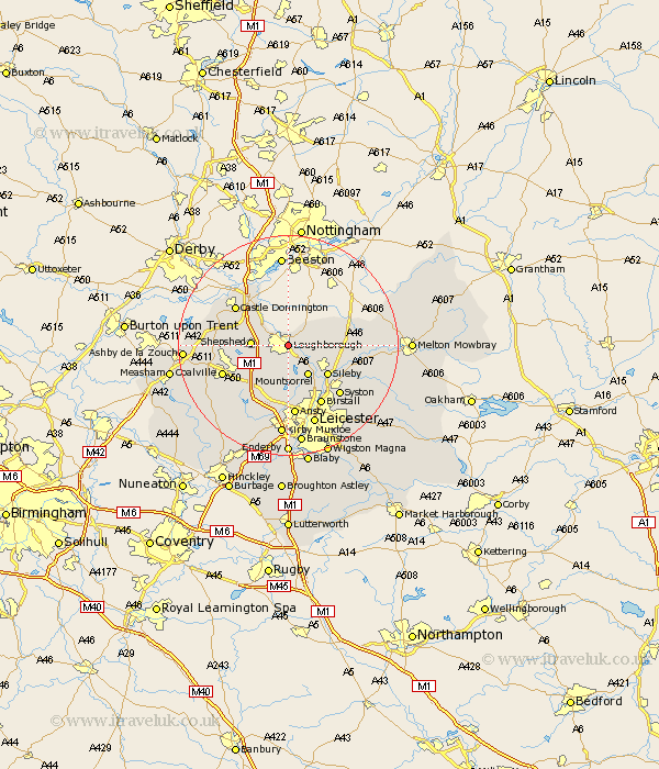
Leicestershire Map Showing Location of Loughborough
Population: 47739
Area Size (ha): 1268
District: Charnwood
Easting: 453971 Northing: 319126
Latitude: 52.77 Longitude: -1.2
 = Loughborough
Area Size (ha): 1268
District: Charnwood
Easting: 453971 Northing: 319126
Latitude: 52.77 Longitude: -1.2
= Loughborough
This Loughborough map below is supplied by Google. Use the tools in the top left corner to zoom into street level or zoom out for a road map, you may also need to zoom in to see Loughborough on the map. Click and drag the map to move around. If the map fails to load try and refresh your browser or zoom in or out (+ or -).
Update - it seems Google no longer allow people to use their maps for free! This Loughborough map sometimes loads and sometimes gives a error. I am working on a solution.
Closest 30 Towns or Cities to Loughborough (Population over 500)
Hathern 3.84km Quorndon 4.34km Barrow upon Soar 5.01km Barrow 5.01km Woodhouse 5.56km Burton on the Wolds 5.61km Burton 5.61km Burton-on-the-Wolds 5.61km Shepshed 6.29km Sheepshed 6.29km Mountsorrel 6.5km Wymeswold 6.98km Wimeswould 6.98km Kegworth 7.14km Rothley 8.67km Sileby 8.73km Belton 8.97km Diseworth 9.7km Swannington 10.76km Castle Donnington 11.63km Castle Donington 11.63km Markfield 12.46km Birstall 12.46km Rearsby 12.52km Coalville 12.52km Syston 12.91km Anstey 13.02km Ansty 13.02km Worthington 13.46km Breedon 13.58km