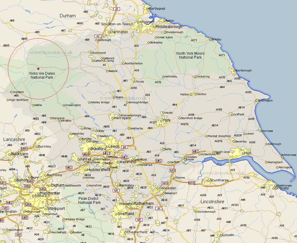
Yorkshire Map Showing Location of Appersett
District: Richmondshire
Easting: 385901 Northing: 489415
Latitude: 54.3 Longitude: -2.22
 = Appersett
Easting: 385901 Northing: 489415
Latitude: 54.3 Longitude: -2.22
= Appersett
This Appersett map below is supplied by Google. Use the tools in the top left corner to zoom into street level or zoom out for a road map, you may also need to zoom in to see Appersett on the map. Click and drag the map to move around. If the map fails to load try and refresh your browser or zoom in or out (+ or -).
Update - it seems Google no longer allow people to use their maps for free! This Appersett map sometimes loads and sometimes gives a error. I am working on a solution.
Closest 30 Towns or Cities to Appersett (Population over 500)
Hawes 1.08km Bradley 18.69km Ingleton 23.29km Clapham 24.74km Leyburn 25.95km Middleham 26.03km Settle 26.14km Burton in Lonsdale 27.7km Giggleswick 27.99km Bentham 28.88km High Bentham 28.88km Grassington 30.06km Threshfield 30.7km Richmond 33.24km Long Preston 33.43km Hellifield 35.22km Gilling 35.62km Gargrave 36.03km Bewerley 37.92km Masham 37.95km Catterick 38.54km Crakehall 38.93km Grewelthorpe 39.04km Skipton 39.28km Kirkby Malzeard 39.7km Embsay 40.06km Melsonby 40.1km Middleton Tyas 40.31km Scorton 41.03km Barton 41.11km