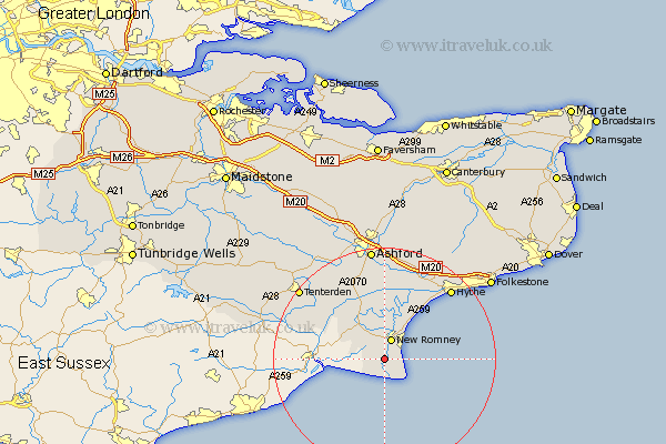
Kent Map Showing Location of Lydd
Population: 3231
Area Size (ha): 120
District: Shepway
Easting: 604843 Northing: 120840
Latitude: 50.95 Longitude: 0.92
 = Lydd
Area Size (ha): 120
District: Shepway
Easting: 604843 Northing: 120840
Latitude: 50.95 Longitude: 0.92
= Lydd
This Lydd map below is supplied by Google. Use the tools in the top left corner to zoom into street level or zoom out for a road map, you may also need to zoom in to see Lydd on the map. Click and drag the map to move around. If the map fails to load try and refresh your browser or zoom in or out (+ or -).
Update - it seems Google no longer allow people to use their maps for free! This Lydd map sometimes loads and sometimes gives a error. I am working on a solution.
Closest 30 Towns or Cities to Lydd (Population over 500)
New Romney 3.88km Dymchurch 9.44km Rockinge 11.36km Ruckinge 11.36km Ham Street 12.06km Orlestone 13.79km Aldington 15.01km Lympne 15.33km Wittersham 16.16km Woodchurch 16.69km Mersham 16.72km Kingsnorth 17.32km Hythe 17.45km Sellinge 17.67km Sellindge 17.67km Shadoxhurst 18.09km Smeeth 18.86km Tenterden 19.9km High Halden 20.38km Hinxhill 20.42km Ashford 20.52km Brabourne 21.2km Bethersden 21.3km Rolvenden 21.89km Lyminge 21.9km Kennington 22.36km Hothfield 23.31km Folkstone 23.83km Folkestone 23.83km Hawkinge 24.16km