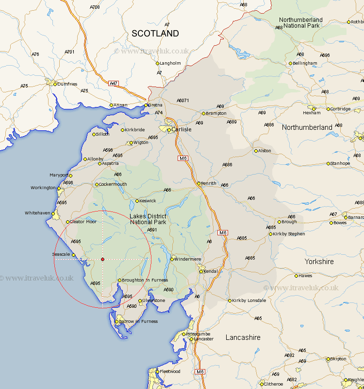
Cumbria Map Showing Location of Eskdale Green
Population: 264
District: Copeland
Easting: 314463 Northing: 497613
Latitude: 54.37 Longitude: -3.32
 = Eskdale Green
District: Copeland
Easting: 314463 Northing: 497613
Latitude: 54.37 Longitude: -3.32
= Eskdale Green
This Eskdale Green map below is supplied by Google. Use the tools in the top left corner to zoom into street level or zoom out for a road map, you may also need to zoom in to see Eskdale Green on the map. Click and drag the map to move around. If the map fails to load try and refresh your browser or zoom in or out (+ or -).
Update - it seems Google no longer allow people to use their maps for free! This Eskdale Green map sometimes loads and sometimes gives a error. I am working on a solution.
Closest 30 Towns or Cities to Eskdale Green (Population over 500)
Gosforth 8.41km Seascale 10.95km Bootle 11.58km Coniston 16.2km Conistan 16.2km Egremont 17.06km Millom 18.82km Hawkshead 20.52km Colton 20.56km Cleator Moor 21.11km Askam 21.4km Askam in Furness 21.4km Frizington 21.43km Lamplugh 22.88km Ulverstone 23.27km Ulverston 23.27km Ambleside 23.33km Pennington 23.61km St Bega 24.42km Saint Bega 24.42km St Bees 24.42km Saint Bees 24.42km St. Bega 24.42km St. Bees 24.42km Haverthwaite 24.47km Lindal 24.73km Lindal in Furness 24.73km Windermere 25.91km Dalton 25.99km Dalton in Furness 25.99km