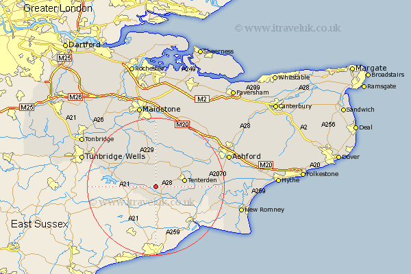
Kent Map Showing Location of Beneden
Population: 2230
District: Tunbridge Wells
Easting: 581046 Northing: 131084
Latitude: 51.05 Longitude: 0.58
 = Beneden
District: Tunbridge Wells
Easting: 581046 Northing: 131084
Latitude: 51.05 Longitude: 0.58
= Beneden
This Beneden map below is supplied by Google. Use the tools in the top left corner to zoom into street level or zoom out for a road map, you may also need to zoom in to see Beneden on the map. Click and drag the map to move around. If the map fails to load try and refresh your browser or zoom in or out (+ or -).
Update - it seems Google no longer allow people to use their maps for free! This Beneden map sometimes loads and sometimes gives a error. I am working on a solution.
Closest 30 Towns or Cities to Beneden (Population over 500)
Sandhurst 3.88km Rolvenden 3.96km Cranbrook 5.09km Hawkhurst 6.11km Biddenden 6.57km Tenterden 8.35km Frittenden 9.26km Wittersham 9.87km High Halden 10.03km Goudhurst 10.85km Headcorn 11.36km Smarden 11.6km Staplehurst 11.66km Horsmonden 12.84km Woodchurch 12.95km Marden 14.22km Lamberhurst 14.46km Bethersden 14.8km Brenchley 15.8km Sutton Valence 16.68km Shadoxhurst 17.22km Ulcombe 17.32km Hunton 18.08km Egerton 18.15km Ham Street 18.64km Orlestone 18.73km Pluckley 18.84km Boughton Monchelsea 18.86km Paddock Wood 19.06km Linton 19.11km