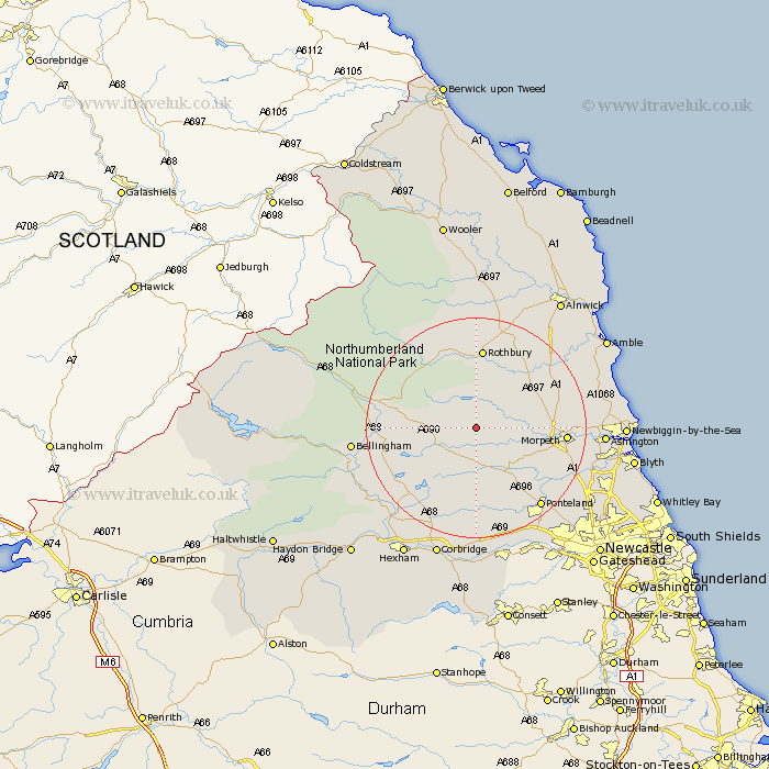
Northumberland Map Showing Location of Rothley
Population: 136
District: Alnwick
Easting: 405305 Northing: 587676
Latitude: 55.18 Longitude: -1.92
 = Rothley
District: Alnwick
Easting: 405305 Northing: 587676
Latitude: 55.18 Longitude: -1.92
= Rothley
This Rothley map below is supplied by Google. Use the tools in the top left corner to zoom into street level or zoom out for a road map, you may also need to zoom in to see Rothley on the map. Click and drag the map to move around. If the map fails to load try and refresh your browser or zoom in or out (+ or -).
Update - it seems Google no longer allow people to use their maps for free! This Rothley map sometimes loads and sometimes gives a error. I am working on a solution.
Closest 30 Towns or Cities to Rothley (Population over 500)
Longhorsley 11.02km Longframlington 13.97km Hebron 14.81km Rothbury 14.87km Morpeth 14.93km Otterburn 16.29km Stamfordham 16.98km Hepscott 17.34km Swarland 17.42km Felton 17.67km Pegswood 18.09km Ponteland 18.22km Stannington 18.39km Thirston 18.51km East Thirston 18.51km Challerton 20.35km Chollerton 20.35km Bellingham 20.45km Dinnington 20.97km Ashington 21.08km Humshaugh 21.64km Bedlington 21.78km Ellington 22.52km Wark 23.06km Dudley 23.71km Woolsington 23.74km Sandhoe 23.8km East Chevington 23.88km Lynemouth 23.98km Ovingham 24.29km