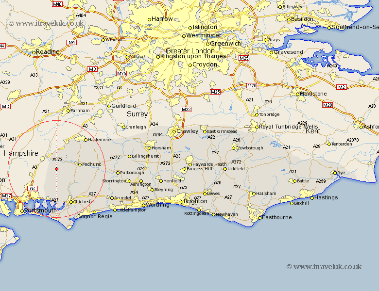
Sussex Map Showing Location of East Harting
Population: 1407
District: Chichester
Easting: 479573 Northing: 119258
Latitude: 50.97 Longitude: -0.87
 = East Harting
District: Chichester
Easting: 479573 Northing: 119258
Latitude: 50.97 Longitude: -0.87
= East Harting
This East Harting map below is supplied by Google. Use the tools in the top left corner to zoom into street level or zoom out for a road map, you may also need to zoom in to see East Harting on the map. Click and drag the map to move around. If the map fails to load try and refresh your browser or zoom in or out (+ or -).
Update - it seems Google no longer allow people to use their maps for free! This East Harting map sometimes loads and sometimes gives a error. I am working on a solution.
Closest 30 Towns or Cities to East Harting (Population over 500)
Rogate 4.38km Iping 6.12km Stoughton 9.35km Midhurst 9.52km Funtington 11.18km Linchmere 12.35km Fernhurst 12.85km Graffham 13.37km Westbourne 13.44km Southbourne 13.44km Lavant 14.23km Lurgashall 15.06km Fishbourne 15.55km Chichester 15.94km Bosham 16.68km Boxgrove 16.7km Tangmere 16.7km Tillington 17.6km Oving 18.19km West Thorney 18.68km Petworth 18.76km Northchapel 18.77km North Chapel 18.77km Dunnington 19.44km Donnington 19.44km Hayling Island 19.82km Mundham 20.26km North Mundham 20.26km Birdham 20.53km Slindon 20.88km