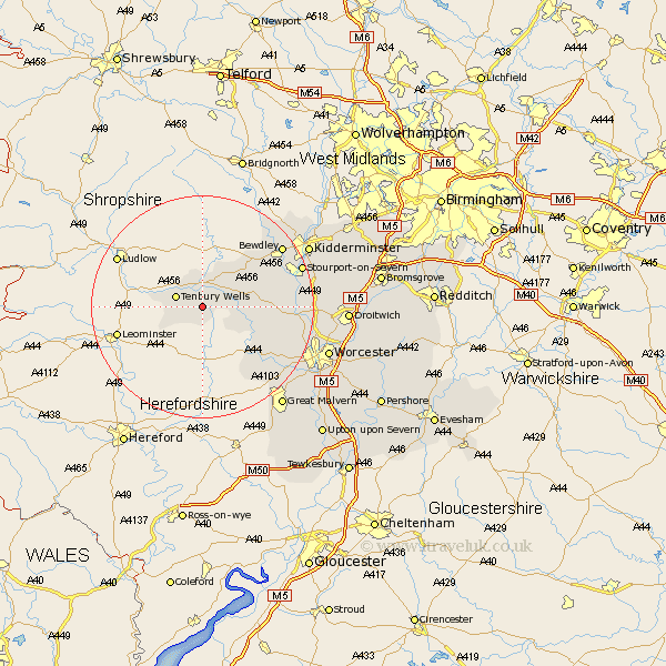
Worcestershire Map Showing Location of Hanley Child
Population: 288
District: Malvern Hills
Easting: 364758 Northing: 265186
Latitude: 52.28 Longitude: -2.52
 = Hanley Child
District: Malvern Hills
Easting: 364758 Northing: 265186
Latitude: 52.28 Longitude: -2.52
= Hanley Child
This Hanley Child map below is supplied by Google. Use the tools in the top left corner to zoom into street level or zoom out for a road map, you may also need to zoom in to see Hanley Child on the map. Click and drag the map to move around. If the map fails to load try and refresh your browser or zoom in or out (+ or -).
Update - it seems Google no longer allow people to use their maps for free! This Hanley Child map sometimes loads and sometimes gives a error. I am working on a solution.
Closest 30 Towns or Cities to Hanley Child (Population over 500)
Tenbury Wells 4.9km Tenbury 4.9km Lindridge 5.04km Clifton 7.75km Clifton upon Teme 7.75km Rock 9.69km Abberley 10.37km Great Witley 11.34km Martley 11.62km Astley 13.73km Suckley 14.64km Bewdley 17.56km Leigh 17.58km Holt 18.52km Stourport 18.54km Stourport on Severn 18.54km Stourport-on-Severn 18.54km Grimley 18.98km Ombersley 19.37km Hallow 19.61km Hartlebury 20.05km Upper Arley 20.16km Arley 20.16km Kidderminster 21.26km Fernhill Heath 22.26km Powick 22.32km Malvern 23km Great Malvern 23km Stone 23.43km Worcester 23.47km