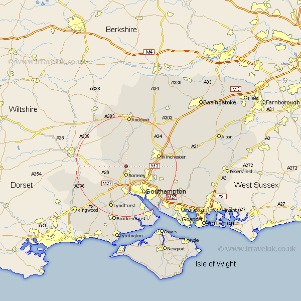
Hampshire Map Showing Location of Timsbury
District: Test Valley
Easting: 435068 Northing: 124325
Latitude: 51.02 Longitude: -1.5
 = Timsbury
Easting: 435068 Northing: 124325
Latitude: 51.02 Longitude: -1.5
= Timsbury
This Timsbury map below is supplied by Google. Use the tools in the top left corner to zoom into street level or zoom out for a road map, you may also need to zoom in to see Timsbury on the map. Click and drag the map to move around. If the map fails to load try and refresh your browser or zoom in or out (+ or -).
Update - it seems Google no longer allow people to use their maps for free! This Timsbury map sometimes loads and sometimes gives a error. I am working on a solution.
Closest 30 Towns or Cities to Timsbury (Population over 500)
Michelmersh 1.85km Michlemersh 1.85km Romsey 3.71km Kings Somborne 5.68km Sherfield English 6.91km Hursley 7km West Wellow 8.06km Broughton 8.19km Stockbridge 9.34km Chilworth 9.44km Sparsholt 9.87km Otterbourne 10.66km Totton 11.18km Compton 11.66km Eastleigh 11.88km Nether Wallop 12.06km Bramshaw 12.36km Cadnam 12.56km Twyford 12.82km Southampton 12.83km Bishopstoke 12.92km Eling 13.03km Winchester 13.57km Over Wallop 14.73km Itchen 15.34km Chilbolton 15.54km Marchwood 15.55km Kings Worthy 15.82km West End 16.12km Minstead 16.4km