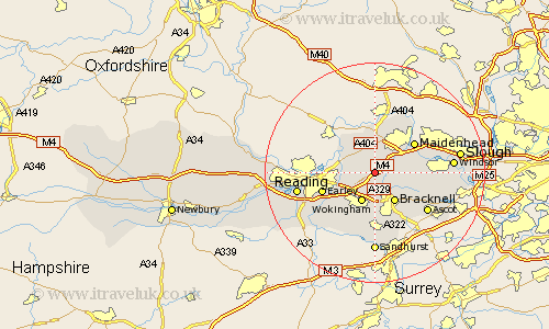
Berkshire Map Showing Location of Waltham St. Lawrence
Population: 1232
Easting: 483346 Northing: 174929
Latitude: 51.47 Longitude: -0.8
 = Waltham St. Lawrence
Easting: 483346 Northing: 174929
Latitude: 51.47 Longitude: -0.8
= Waltham St. Lawrence
This Waltham St. Lawrence map below is supplied by Google. Use the tools in the top left corner to zoom into street level or zoom out for a road map, you may also need to zoom in to see Waltham St. Lawrence on the map. Click and drag the map to move around. If the map fails to load try and refresh your browser or zoom in or out (+ or -).
Update - it seems Google no longer allow people to use their maps for free! This Waltham St. Lawrence map sometimes loads and sometimes gives a error. I am working on a solution.
Closest 30 Towns or Cities to Waltham St. Lawrence (Population over 500)
White Waltham 2.96km Twyford 3.46km Binfield 3.89km Wagrave 4.97km Wargrave 4.97km Wokingham 6.02km Woodley 6.06km Bracknell 6.55km Sonning 6.93km Winnersh 7.23km Warfield 7.23km Hurley 7.5km Bray 7.85km Winkfield 7.86km Maidenhead 8.88km Remenham 9.39km Bisham 9.55km Earley 9.96km Barkham 10.93km Arborfield 10.97km Aberfield 10.97km Crowthorne 11.18km Cookham 11.56km Ascot 11.85km Shinfield 12.77km Finchampstead 13.43km Frogmore House 13.85km Frogmore 13.85km Sunninghill 13.93km Windsor 13.97km