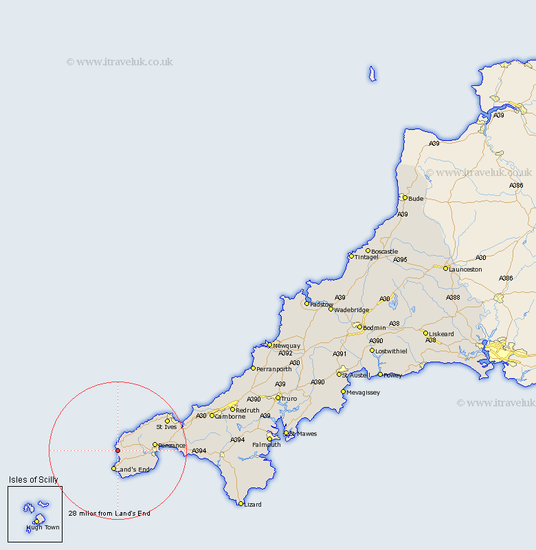
Cornwall Map Showing Location of Saint Just
Population: 2027
Area Size (ha): 33
District: Penwith
Easting: 135532 Northing: 30696
Latitude: 50.12 Longitude: -5.7
 = Saint Just
Area Size (ha): 33
District: Penwith
Easting: 135532 Northing: 30696
Latitude: 50.12 Longitude: -5.7
= Saint Just
This Saint Just map below is supplied by Google. Use the tools in the top left corner to zoom into street level or zoom out for a road map, you may also need to zoom in to see Saint Just on the map. Click and drag the map to move around. If the map fails to load try and refresh your browser or zoom in or out (+ or -).
Update - it seems Google no longer allow people to use their maps for free! This Saint Just map sometimes loads and sometimes gives a error. I am working on a solution.
Closest 30 Towns or Cities to Saint Just (Population over 500)
Sennen 5.56km Sennan 5.56km Sancreed 7.37km St. Buryan 8.14km St Burian 8.14km St. Burian 8.14km St Buryan 8.14km Saint Buryan 8.14km Saint Burian 8.14km Madron 9.68km Penzance 10.85km Ludgvan 15.56km Marazion 16.74km Saint Ives 16.99km St Ives 16.99km St. Ives 16.99km Perranuthnoe 17.82km Saint Hilary 20.2km St Hilary 20.2km St. Hilary 20.2km Germoe 22.58km Germol 22.58km Heyl 23.75km Hayle 23.75km Gwinear 24.88km Breage 26.21km Porthleven 27.59km Crowan 28.75km Camborne 29.48km Troon 29.56km