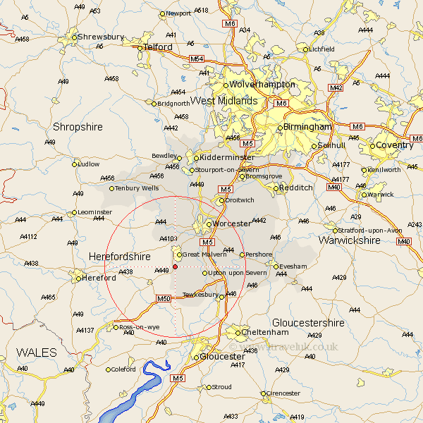
Worcestershire Map Showing Location of Malvern Wells
Population: 3169
District: Malvern Hills
Easting: 377161 Northing: 242873
Latitude: 52.08 Longitude: -2.33
 = Malvern Wells
District: Malvern Hills
Easting: 377161 Northing: 242873
Latitude: 52.08 Longitude: -2.33
= Malvern Wells
This Malvern Wells map below is supplied by Google. Use the tools in the top left corner to zoom into street level or zoom out for a road map, you may also need to zoom in to see Malvern Wells on the map. Click and drag the map to move around. If the map fails to load try and refresh your browser or zoom in or out (+ or -).
Update - it seems Google no longer allow people to use their maps for free! This Malvern Wells map sometimes loads and sometimes gives a error. I am working on a solution.
Closest 30 Towns or Cities to Malvern Wells (Population over 500)
Great Malvern 3.88km Malvern 3.88km Welland 4.35km Castlemorton 6.01km Hanley Castle 6.83km Severn Stoke 8.18km Seven Stoke 8.18km Upton-on-Severn 8.19km Upton on Severn 8.19km Upton 8.19km Upton upon Severn 8.19km Kempsey 10.67km Powick 10.88km Suckley 10.88km Leigh 11.17km Eldersfield 11.35km Ripple 11.67km Wadborough 13.06km Defford 14.8km Eckington 14.92km Bredon 15.82km Worcester 15.85km Hallow 15.88km Martley 16.83km Peopleton 17.57km Grimley 17.62km Pershore 18.59km Fernhill Heath 19km Clifton upon Teme 19.39km Clifton 19.39km