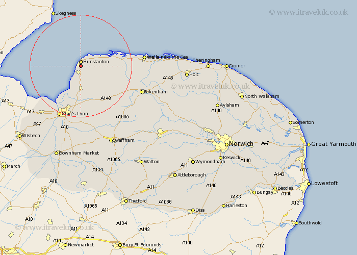
Norfolk Map Showing Location of New Hunstanton
District: King's Lynn and West Norfolk
Easting: 568003 Northing: 340282
Latitude: 52.93 Longitude: 0.5
 = New Hunstanton
Easting: 568003 Northing: 340282
Latitude: 52.93 Longitude: 0.5
= New Hunstanton
This New Hunstanton map below is supplied by Google. Use the tools in the top left corner to zoom into street level or zoom out for a road map, you may also need to zoom in to see New Hunstanton on the map. Click and drag the map to move around. If the map fails to load try and refresh your browser or zoom in or out (+ or -).
Update - it seems Google no longer allow people to use their maps for free! This New Hunstanton map sometimes loads and sometimes gives a error. I am working on a solution.
Closest 30 Towns or Cities to New Hunstanton (Population over 500)
Hunstanton 1.86km Heacham 2.16km Sedgeford 5km Snettisham 7.41km Ingoldisthorpe 7.49km Ingoldesthorpe 7.49km Docking 8.65km Dersingham 9.26km Brancaster 10.71km Great Bircham 12.88km Bircham 12.88km Burnham Market 15.75km Syderstone 17.24km North Wootton 17.27km South Creake 18.73km Grimston 18.83km South Wootton 19.06km Tattersett 19.2km Tatterset 19.2km East Rudham 19.48km Great Massingham 21.64km Massingham 21.64km King's Lynn 21.84km Kings Lynn 21.84km Lynn Regis 21.84km Lynn 21.84km East Winch 22.24km Gayton 22.49km Clenchwarton 22.74km Sculthorpe 23.18km