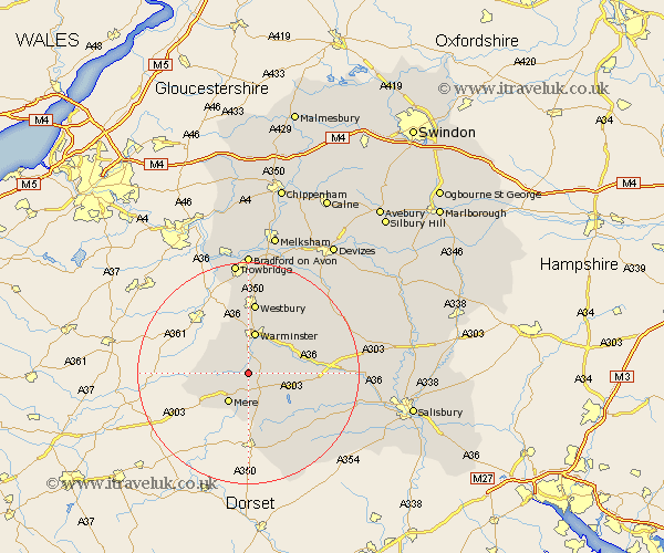
Wiltshire Map Showing Location of Monkton Deverill
District: Salisbury
Easting: 386007 Northing: 137191
Latitude: 51.13 Longitude: -2.2
 = Monkton Deverill
Easting: 386007 Northing: 137191
Latitude: 51.13 Longitude: -2.2
= Monkton Deverill
This Monkton Deverill map below is supplied by Google. Use the tools in the top left corner to zoom into street level or zoom out for a road map, you may also need to zoom in to see Monkton Deverill on the map. Click and drag the map to move around. If the map fails to load try and refresh your browser or zoom in or out (+ or -).
Update - it seems Google no longer allow people to use their maps for free! This Monkton Deverill map sometimes loads and sometimes gives a error. I am working on a solution.
Closest 30 Towns or Cities to Monkton Deverill (Population over 500)
Longbridge Deverill 3.71km Hindon 5.95km Mere 6.56km Warminster 7.51km East Knoyle 7.76km Bishop's Knoyle 7.76km Heytesbury 8.04km Zeal 8.95km Zeals 8.95km Corsley 9.91km Codford 10.63km Tisbury 11.01km Dilton 11.12km Semley 11.66km Westbury 13.03km Bratton 15.93km Dinton 16.12km Edington 16.39km North Bradley 16.72km Fovant 16.76km Southwick 16.84km Longford 18.61km Steeple Langford 18.61km West Lavington 19.04km Erlestoke 19.09km Steeple Ashton 19.11km Hilperton 20.43km Trowbridge 20.53km Westwood 21.2km Shrewton 21.65km