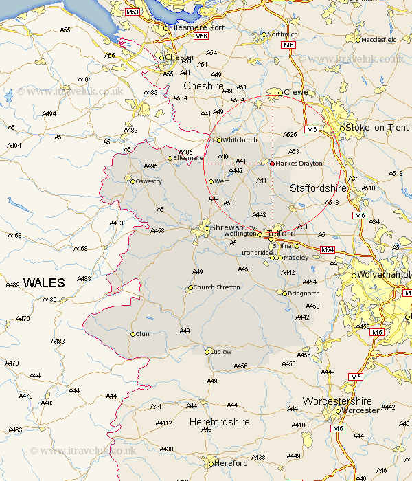
Shropshire Map Showing Location of Market Drayton
Population: 9302
Area Size (ha): 291
District: North Shropshire
Easting: 368612 Northing: 333755
Latitude: 52.9 Longitude: -2.47
 = Market Drayton
Area Size (ha): 291
District: North Shropshire
Easting: 368612 Northing: 333755
Latitude: 52.9 Longitude: -2.47
= Market Drayton
This Market Drayton map below is supplied by Google. Use the tools in the top left corner to zoom into street level or zoom out for a road map, you may also need to zoom in to see Market Drayton on the map. Click and drag the map to move around. If the map fails to load try and refresh your browser or zoom in or out (+ or -).
Update - it seems Google no longer allow people to use their maps for free! This Market Drayton map sometimes loads and sometimes gives a error. I am working on a solution.
Closest 30 Towns or Cities to Market Drayton (Population over 500)
Cheswardine 5km Norton in Hales 5.67km Stoke upon Tern 7.14km Stoke 7.14km Hinstock 7.5km Broughton 7.83km Hodnet 9.6km Woore 10.28km Precs 13.55km Prees 13.55km Chetwynd 13.73km Newport 14.13km Cherrington 14.99km Edgmond 15.2km Stanton 15.4km Stanton upon Hine Heath 15.4km Whitchurch 16.31km Whixall 16.77km Wem 17.68km Shawbury 17.89km High Ercall 18.93km Ercall Magna 18.93km Lilleshall 19.07km Trench 20.38km Downington 20.5km Donnington 20.5km Woodcote 20.59km Rodington 21.1km Loppington 21.57km Ketley 22.27km