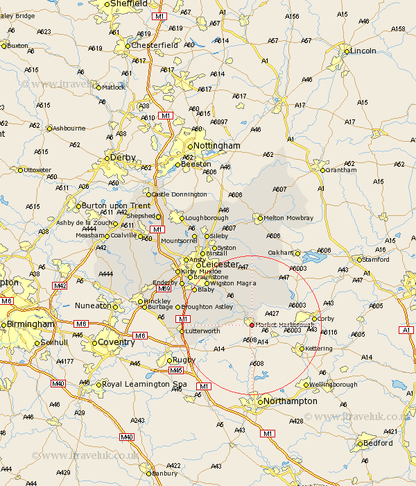
Leicestershire Map Showing Location of Market Harborough
Population: 16265
Area Size (ha): 530
District: Harborough
Easting: 473587 Northing: 286010
Latitude: 52.47 Longitude: -0.92
 = Market Harborough
Area Size (ha): 530
District: Harborough
Easting: 473587 Northing: 286010
Latitude: 52.47 Longitude: -0.92
= Market Harborough
This Market Harborough map below is supplied by Google. Use the tools in the top left corner to zoom into street level or zoom out for a road map, you may also need to zoom in to see Market Harborough on the map. Click and drag the map to move around. If the map fails to load try and refresh your browser or zoom in or out (+ or -).
Update - it seems Google no longer allow people to use their maps for free! This Market Harborough map sometimes loads and sometimes gives a error. I am working on a solution.
Closest 30 Towns or Cities to Market Harborough (Population over 500)
Great Bowden 2.16km Bowden 2.16km Lubenham 2.26km Kibworth Harcourt 8.67km Kibworth 8.67km Husbands Bosworth 9.22km Hallaton 10.85km Great Easton 12.58km Walton-in-Knaptoft 13.55km Walton 13.55km Great Glen 13.64km Billesdon 14.87km Gilmorton 15.81km Gilmarton 15.81km Oadby 17.18km Houghton-on-the-Hill 17.28km Houghton 17.28km Houghton on the Hill 17.28km Countesthorpe 17.34km Glen Parka 17.52km Glen Parva 17.52km Wigston Magna 17.94km Wigston 17.94km Lutterworth 19.29km Blaby 19.31km Cosby 20.29km Broughton Astley 21.06km Whetstone 21.2km Narborough 22.16km Twyford 22.24km