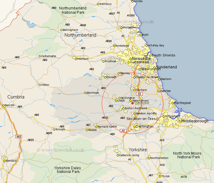
Durham Map Showing Location of Kirk Merrington
District: Sedgefield
Easting: 426860 Northing: 532119
Latitude: 54.68 Longitude: -1.58
 = Kirk Merrington
Easting: 426860 Northing: 532119
Latitude: 54.68 Longitude: -1.58
= Kirk Merrington
This Kirk Merrington map below is supplied by Google. Use the tools in the top left corner to zoom into street level or zoom out for a road map, you may also need to zoom in to see Kirk Merrington on the map. Click and drag the map to move around. If the map fails to load try and refresh your browser or zoom in or out (+ or -).
Update - it seems Google no longer allow people to use their maps for free! This Kirk Merrington map sometimes loads and sometimes gives a error. I am working on a solution.
Closest 30 Towns or Cities to Kirk Merrington (Population over 500)
Spennymoor 2.08km Ferryhill 2.14km Coundon 4.67km West Cornforth 4.67km Cornforth 4.67km Bishop Middleham 6.43km Bishop Auckland 6.51km Coxhoe 6.52km Bowburn 7.02km Shildon 7.02km Newton Aycliffe 7.48km Brandon 7.72km Willington 8.37km Durham 9.34km Fishburn 9.64km Shincliffe 9.81km Crook 9.82km Sedgefield 10.33km Trimdon 10.87km West Auckland 11.13km Sherburn 11.28km Etherley 11.34km High Etherley 11.34km Ushaw Moor 11.92km Thornley 12.16km Witton Gilbert 13.37km Stillington 13.38km Esh 13.41km Evenwood 13.93km Wingate 14km