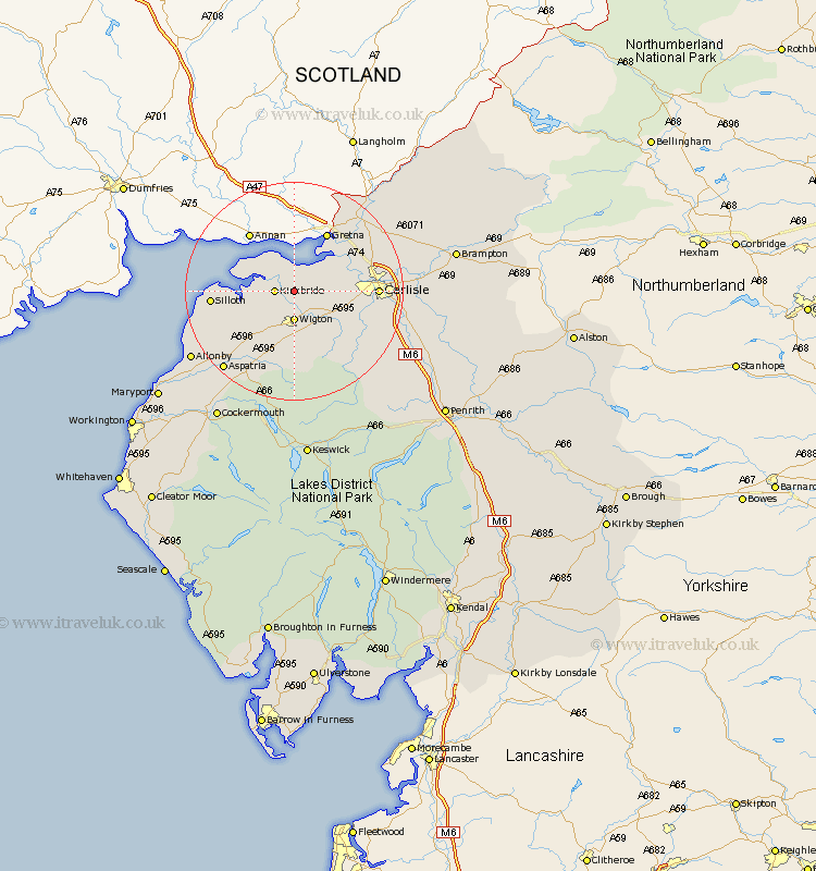
Cumbria Map Showing Location of Fingland
District: Allerdale
Easting: 326231 Northing: 554898
Latitude: 54.88 Longitude: -3.15
 = Fingland
Easting: 326231 Northing: 554898
Latitude: 54.88 Longitude: -3.15
= Fingland
This Fingland map below is supplied by Google. Use the tools in the top left corner to zoom into street level or zoom out for a road map, you may also need to zoom in to see Fingland on the map. Click and drag the map to move around. If the map fails to load try and refresh your browser or zoom in or out (+ or -).
Update - it seems Google no longer allow people to use their maps for free! This Fingland map sometimes loads and sometimes gives a error. I am working on a solution.
Closest 30 Towns or Cities to Fingland (Population over 500)
Kirkbride 3.2km Wigton 5.56km Burgh-by-Sands 7.39km Burgh 7.39km Burgh by Sands 7.39km Thursby 8.48km Bowness on Solway 8.55km Bowness-on-Solway 8.55km Westward 11.17km Bromfield 11.9km Rockcliffe 12.02km Rockcliff 12.02km Dalston 12.03km Carlisle 13.86km Stanwix 13.98km Silloth 13.98km Longtown 17.48km Caldbeck 17.87km Hesket Newmarket 18.74km Aspatria 18.91km Wetheral 21.41km Crosscanonby 24.66km Irthington 25.13km Hayton 25.65km Bridekirk 26.22km Cockermouth 27.29km Skelton 27.3km Dearham 27.3km Brampton 27.64km Ainstable 28.24km