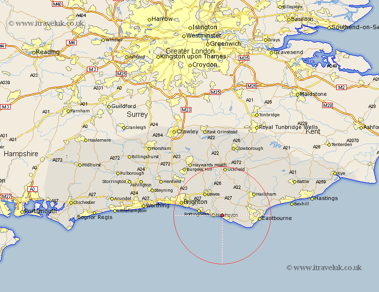
Sussex Map Showing Location of Bishopstone
District: Lewes
Easting: 546846 Northing: 100323
Latitude: 50.78 Longitude: 0.08
 = Bishopstone
Easting: 546846 Northing: 100323
Latitude: 50.78 Longitude: 0.08
= Bishopstone
This Bishopstone map below is supplied by Google. Use the tools in the top left corner to zoom into street level or zoom out for a road map, you may also need to zoom in to see Bishopstone on the map. Click and drag the map to move around. If the map fails to load try and refresh your browser or zoom in or out (+ or -).
Update - it seems Google no longer allow people to use their maps for free! This Bishopstone map sometimes loads and sometimes gives a error. I am working on a solution.
Closest 30 Towns or Cities to Bishopstone (Population over 500)
Seaford 2.19km Newhaven 3.52km Alfriston 5.04km Chalvington 8.77km Friston 9km Jevington 9.37km Rottingdean 9.55km Saltdean 9.96km Kingston near Lewes 10.22km Kingston 10.22km Polegate 10.71km Ringmer 11.18km Lewes 11.63km Laughton 11.66km Barcombe Mills Station 13.44km Plumpton 14.54km Chiddingly 14.75km Hellingly 14.93km Eastbourne 15.31km Hailsham 15.87km East Hoathly 15.95km Isfield 16.72km Brighton 17.31km Pevensey 18.84km Framfield 18.87km Horam 18.89km Horeham 18.89km Chailey 19.12km Hove 19.55km Ditchling 19.64km