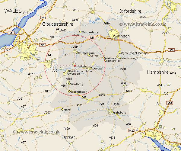
Wiltshire Map Showing Location of Melksham
Population: 12920
Area Size (ha): 316
District: West Wiltshire
Easting: 390719 Northing: 163134
Latitude: 51.37 Longitude: -2.13
 = Melksham
Area Size (ha): 316
District: West Wiltshire
Easting: 390719 Northing: 163134
Latitude: 51.37 Longitude: -2.13
= Melksham
This Melksham map below is supplied by Google. Use the tools in the top left corner to zoom into street level or zoom out for a road map, you may also need to zoom in to see Melksham on the map. Click and drag the map to move around. If the map fails to load try and refresh your browser or zoom in or out (+ or -).
Update - it seems Google no longer allow people to use their maps for free! This Melksham map sometimes loads and sometimes gives a error. I am working on a solution.
Closest 30 Towns or Cities to Melksham (Population over 500)
Semington 2.19km Broughton Gifford 3.47km Laycock 3.88km Lacock 3.88km Seend 3.94km Atworth 4.98km Holt 4.99km Whitley 5.06km Bradford-on-Avon 5.94km Bradford on Avon 5.94km Hilperton 6.56km Rowde 7.19km Worton 7.24km Steeple Ashton 7.42km Corsham 7.76km Trowbridge 8.9km Chippenham 9.33km Box 9.82km Potterne 9.83km Erlestoke 10.37km Roundway 10.41km Devizes 10.58km North Bradley 10.93km Bratton 11.18km Edington 11.36km Bremhill 11.57km Southwick 11.59km Westwood 11.81km Calne 11.85km Colerne 11.85km