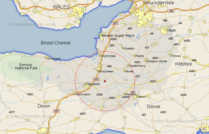
Somerset Map Showing Location of Athelney
District: Taunton Deane
Easting: 334585 Northing: 128324
Latitude: 51.05 Longitude: -2.93
 = Athelney
Easting: 334585 Northing: 128324
Latitude: 51.05 Longitude: -2.93
= Athelney
This Athelney map below is supplied by Google. Use the tools in the top left corner to zoom into street level or zoom out for a road map, you may also need to zoom in to see Athelney on the map. Click and drag the map to move around. If the map fails to load try and refresh your browser or zoom in or out (+ or -).
Update - it seems Google no longer allow people to use their maps for free! This Athelney map sometimes loads and sometimes gives a error. I am working on a solution.
Closest 30 Towns or Cities to Athelney (Population over 500)
Stoke St Gregory 1.86km Stoke Saint Gregory 1.86km Stoke St. Gregory 1.86km North Curry 4.38km Othery 5.09km Curry Rivel 5.09km Fivehead 5.68km Middlezoy 6.03km Creech Saint Michael 6.9km Creech St. Michael 6.9km Creech St Michael 6.9km Langport 7.23km Weston Zoyland 7.42km North Petherton 8.05km West Monkton 8.15km High Ham 8.36km Bridgewater 8.76km Bridgwater 8.76km Hatch Beauchamp 8.76km Durleigh 11.02km Cossington 11.18km Ilton 11.18km Shapwick 11.6km Kingsbury Episcopi 11.92km Kingsbury 11.92km Long Sutton 12.23km Somerton 12.82km Kingston 12.95km Taunton 12.95km Ilminster 13.03km