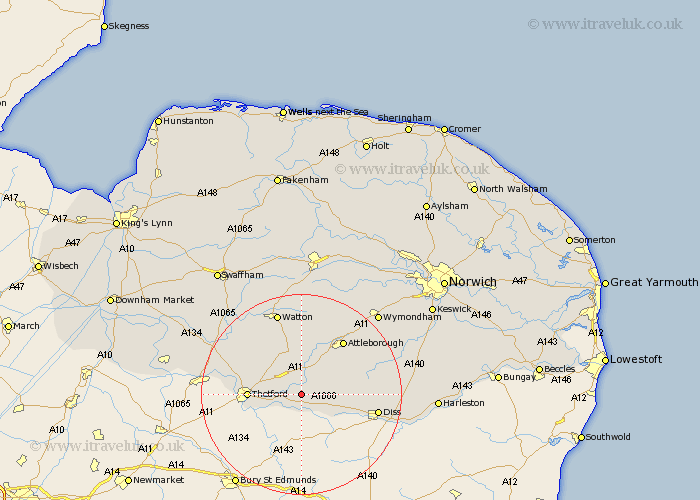
Norfolk Map Showing Location of Harling
Population: 2201
District: Breckland
Easting: 597192 Northing: 283854
Latitude: 52.42 Longitude: 0.9
 = Harling
District: Breckland
Easting: 597192 Northing: 283854
Latitude: 52.42 Longitude: 0.9
= Harling
This Harling map below is supplied by Google. Use the tools in the top left corner to zoom into street level or zoom out for a road map, you may also need to zoom in to see Harling on the map. Click and drag the map to move around. If the map fails to load try and refresh your browser or zoom in or out (+ or -).
Update - it seems Google no longer allow people to use their maps for free! This Harling map sometimes loads and sometimes gives a error. I am working on a solution.
Closest 30 Towns or Cities to Harling (Population over 500)
East Harling 2.92km Garboldisham 5.03km Kenninghall 5.95km Quidenham 6.75km North Lopham 7.03km Hockham 9.33km Banham 9.77km Bressingham 9.78km Thetford 10.17km Old Buckenham 12.58km Rockland St. Peter 13.01km Rockland St Peter 13.01km Rockland Saint Peter 13.01km Rockland 13.01km Attleborough 13.64km Great Ellingham 13.73km Besthorpe 14.33km Roydon 14.67km Griston 14.99km Diss 15.16km Burston 17.06km Watton 17.28km Bunwell 17.46km Carbooke 18.56km Carbrooke 18.56km Scole 18.93km Mundford 19.31km Hingham 19.36km Weeting 19.56km Moulton Saint Michael 19.99km