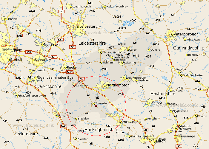
Northamptonshire Map Showing Location of Easton Neston
Population: 74
District: South Northamptonshire
Easting: 470746 Northing: 247035
Latitude: 52.12 Longitude: -0.97
 = Easton Neston
District: South Northamptonshire
Easting: 470746 Northing: 247035
Latitude: 52.12 Longitude: -0.97
= Easton Neston
This Easton Neston map below is supplied by Google. Use the tools in the top left corner to zoom into street level or zoom out for a road map, you may also need to zoom in to see Easton Neston on the map. Click and drag the map to move around. If the map fails to load try and refresh your browser or zoom in or out (+ or -).
Update - it seems Google no longer allow people to use their maps for free! This Easton Neston map sometimes loads and sometimes gives a error. I am working on a solution.
Closest 30 Towns or Cities to Easton Neston (Population over 500)
Towcester 2.17km Whittlebury 3.88km Paulerspury 4.36km Silverstone 5.05km Gayton 5.56km Blisworth 6.01km Pattishall 6.52km Roade 6.79km Potterspury 7.96km Milton 8.15km Hartwell 8.18km Collingtree 8.69km Wootton 9.34km Syresham 9.72km Bugbrooke 9.87km Hardingstone 10.87km Denshanger 10.89km Deanshanger 10.89km Kislingbury 11.12km Helmdon 11.97km Hackleton 12.63km Harpole 13.02km Weedon 13.05km Weedon Beck 13.05km Flore 14.16km Great Houghton 14.36km Houghton 14.36km Brackley 15.59km Greatworth 15.81km Northampton 15.87km