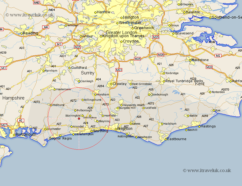
Sussex Map Showing Location of Parham
Population: 214
District: Horsham
Easting: 506639 Northing: 112326
Latitude: 50.9 Longitude: -0.48
 = Parham
District: Horsham
Easting: 506639 Northing: 112326
Latitude: 50.9 Longitude: -0.48
= Parham
This Parham map below is supplied by Google. Use the tools in the top left corner to zoom into street level or zoom out for a road map, you may also need to zoom in to see Parham on the map. Click and drag the map to move around. If the map fails to load try and refresh your browser or zoom in or out (+ or -).
Update - it seems Google no longer allow people to use their maps for free! This Parham map sometimes loads and sometimes gives a error. I am working on a solution.
Closest 30 Towns or Cities to Parham (Population over 500)
Storrington 3.08km Amberley 3.97km West Chiltington 4.38km West Chillington 4.38km Coldwaltham 5.1km Bury 5.84km Washington 5.84km Thakeham 5.96km Pulborough 6.03km Ashington 7.25km Arundel 7.27km Fittleworth 8.06km Findon 8.07km Angmering 9.26km Walberton 10.88km Shipley 11.04km Rustington 11.18km West Ferring 11.36km Ferring 11.36km Ford 11.62km Littlehampton 11.66km Steyning 11.84km Upper Bleeding 11.84km Upper Beeding 11.84km Bramber 11.84km Slindon 11.9km Worthing 12.09km Petworth 12.35km West Grinstead 12.86km Wisborough Green 13.03km