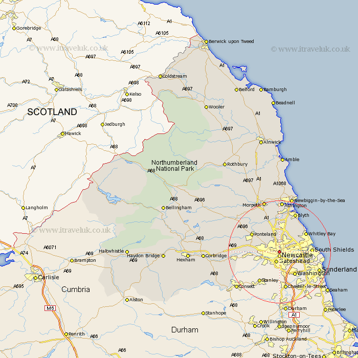
Northumberland Map Showing Location of Jesmond
District: Newcastle upon Tyne
Easting: 425595 Northing: 565492
Latitude: 54.98 Longitude: -1.6
 = Jesmond
Easting: 425595 Northing: 565492
Latitude: 54.98 Longitude: -1.6
= Jesmond
This Jesmond map below is supplied by Google. Use the tools in the top left corner to zoom into street level or zoom out for a road map, you may also need to zoom in to see Jesmond on the map. Click and drag the map to move around. If the map fails to load try and refresh your browser or zoom in or out (+ or -).
Update - it seems Google no longer allow people to use their maps for free! This Jesmond map sometimes loads and sometimes gives a error. I am working on a solution.
Closest 30 Towns or Cities to Jesmond (Population over 500)
Newcastle-on-Tyne 1.85km Newcastle 1.85km Newcastle on Tyne 1.85km Newcastle upon Tyne 1.85km Gosforth 2.14km Wallsend on Tyne 2.72km Wallsend-on-Tyne 2.72km Wallsend 2.72km Long Benton 2.82km Longbenton 2.82km Killingworth 5.95km Shiremoor 6.27km Woolsington 6.48km Seghill 8.07km North Shields 8.46km Newburn 8.71km Dinnington 9.12km Cramlington 9.33km Tynemouth 10.46km Dudley 10.51km Seaton Delaval 10.69km South Shields 11.41km Whitley Bay 11.96km Whitley 11.96km Ponteland 12.1km Seaton Sluice 13.64km Stannington 13.65km Wylam 16.06km Blyth 16.22km Blythe 16.22km