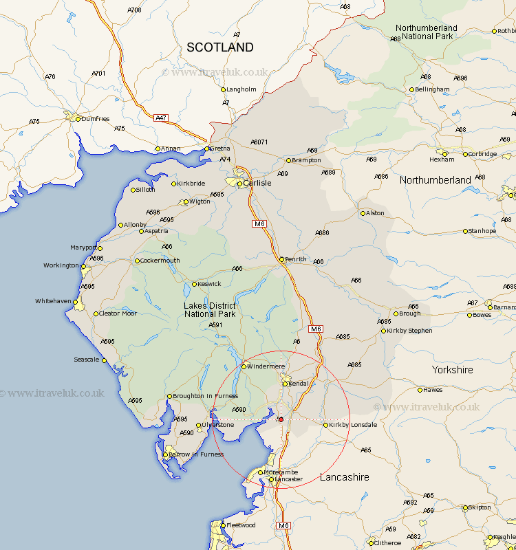
Cumbria Map Showing Location of Milnthorpe
Population: 1868
Area Size (ha): 51
District: South Lakeland
Easting: 350011 Northing: 480393
Latitude: 54.22 Longitude: -2.77
 = Milnthorpe
Area Size (ha): 51
District: South Lakeland
Easting: 350011 Northing: 480393
Latitude: 54.22 Longitude: -2.77
= Milnthorpe
This Milnthorpe map below is supplied by Google. Use the tools in the top left corner to zoom into street level or zoom out for a road map, you may also need to zoom in to see Milnthorpe on the map. Click and drag the map to move around. If the map fails to load try and refresh your browser or zoom in or out (+ or -).
Update - it seems Google no longer allow people to use their maps for free! This Milnthorpe map sometimes loads and sometimes gives a error. I am working on a solution.
Closest 30 Towns or Cities to Milnthorpe (Population over 500)
Heversham 1.85km Beetham 1.85km Levens 3.86km Holme 4.93km Arnside 5.71km Natland 7.72km Kendal 11.18km Kendall 11.18km Kirkby Lonsdale 12.07km Kirkby Londsdale 12.07km Holker 13.53km Lower Holker 13.53km Haverthwaite 16.36km Staveley 17km Colton 19.23km Windermere 19.32km Sedbergh 19.68km Milnthorpe 19.68km Millthrop 19.68km Dent 21.32km Ulverston 21.76km Ulverstone 21.76km Hawkshead 22.53km Great Urswick 23.95km Pennington 24.14km Aldingham 24.38km Tebay 25.22km Lindal 25.55km Lindal in Furness 25.55km Coniston 25.64km