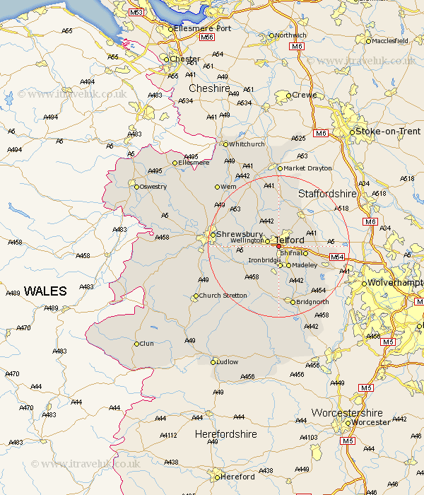
Shropshire Map Showing Location of Telford
Population: 117985
Area Size (ha): 3611
Easting: 368000 Northing: 310000
Latitude: 52.69 Longitude: -2.47
 = Telford
Area Size (ha): 3611
Easting: 368000 Northing: 310000
Latitude: 52.69 Longitude: -2.47
= Telford
This Telford map below is supplied by Google. Use the tools in the top left corner to zoom into street level or zoom out for a road map, you may also need to zoom in to see Telford on the map. Click and drag the map to move around. If the map fails to load try and refresh your browser or zoom in or out (+ or -).
Update - it seems Google no longer allow people to use their maps for free! This Telford map sometimes loads and sometimes gives a error. I am working on a solution.
Closest 30 Towns or Cities to Telford (Population over 500)
Ketley 1.65km Hadley 1.65km Dawley 2.24km Oakengates 3.1km Wellington 3.28km Trench 3.4km Donnington 4.32km Downington 4.32km Ironbridge 5.92km Wrockwardine 6.46km Madeley 6.5km Lilleshall 7.19km Shifnal 7.52km Broseley 7.78km Cherrington 9.11km Barrow Bridge 9.62km Barrow 9.62km Edgmond 9.71km Woodcote 10.78km Much Wenlock 10.91km Rodington 10.97km High Ercall 11.08km Ercall Magna 11.08km Cressage 11.32km Chetwynd 11.85km Newport 12.36km Albrighton 15.14km Berrington 15.8km Shawbury 16.04km Hinstock 16.41km