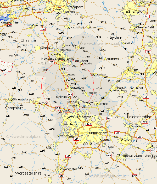
Staffordshire Map Showing Location of Tillington
District: Stafford
Easting: 391015 Northing: 324396
Latitude: 52.82 Longitude: -2.13
 = Tillington
Easting: 391015 Northing: 324396
Latitude: 52.82 Longitude: -2.13
= Tillington
This Tillington map below is supplied by Google. Use the tools in the top left corner to zoom into street level or zoom out for a road map, you may also need to zoom in to see Tillington on the map. Click and drag the map to move around. If the map fails to load try and refresh your browser or zoom in or out (+ or -).
Update - it seems Google no longer allow people to use their maps for free! This Tillington map sometimes loads and sometimes gives a error. I am working on a solution.
Closest 30 Towns or Cities to Tillington (Population over 500)
Hopton 2.9km Stafford 2.91km Seighford 3.36km Haughton 5.82km Bednall 7.14km Weston 8.05km Weston upon Trent 8.05km Eccleshall 8.67km Gnossall 8.68km Gnosall 8.68km Stone 9.26km Penkridge 9.34km Church Eaton 10.01km Colwich 10.75km Hilderstone 11.61km Swinnerton 12.45km Swynnerton 12.45km Wheaton Aston 12.45km High Offley 13.56km Rugeley 14.55km Huntington 14.62km Adbaston 14.68km Barlaston 14.99km Standon 15km Brewood 15km Blymhill 15.02km Fulford 15.48km Colton 15.59km Church Leigh 15.77km Leigh 15.77km