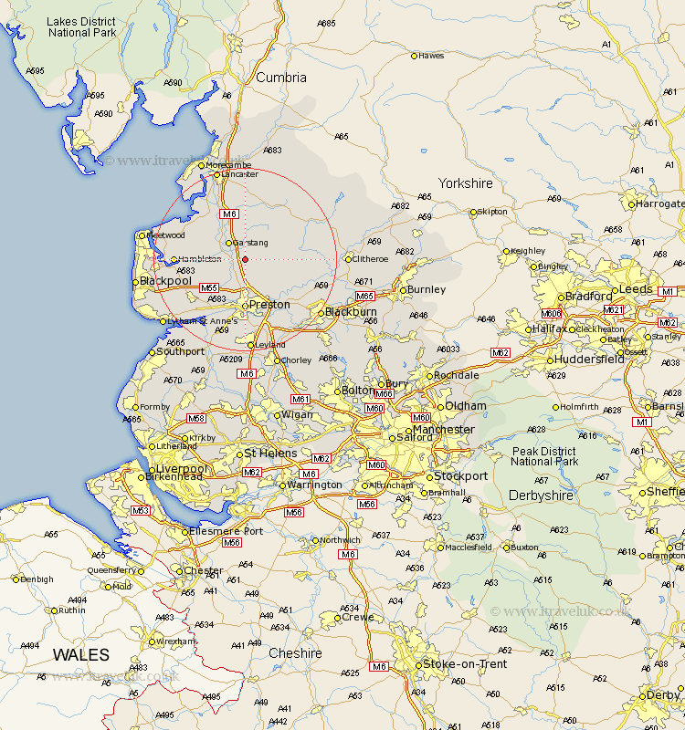
Lancashire Map Showing Location of Claughton
Population: 562
District: Wyre
Easting: 352877 Northing: 441426
Latitude: 53.87 Longitude: -2.72
 = Claughton
District: Wyre
Easting: 352877 Northing: 441426
Latitude: 53.87 Longitude: -2.72
= Claughton
This Claughton map below is supplied by Google. Use the tools in the top left corner to zoom into street level or zoom out for a road map, you may also need to zoom in to see Claughton on the map. Click and drag the map to move around. If the map fails to load try and refresh your browser or zoom in or out (+ or -).
Update - it seems Google no longer allow people to use their maps for free! This Claughton map sometimes loads and sometimes gives a error. I am working on a solution.
Closest 30 Towns or Cities to Claughton (Population over 500)
Catterall 3.28km Garstang 4.94km Barton 5.67km Broughton 5.67km Goosnargh 6.46km Woodplumpton 7.73km Inskip 8.51km Chipping 8.93km Grimsargh 9.22km Longridge 9.5km Great Eccleston 10.01km Eccleston 10.01km Forton 10.24km Preston 11.12km Cockerham 11.34km Elswick 11.55km Lea 12.39km Lea Town 12.39km Samlesbury 12.91km Penwortham 13.02km Kirkham 13.53km Ribchester 14.13km Hambleton 14.21km Singleton 14.69km Great Singleton 14.69km Pilling 15.05km Hutton 15.19km Warton 15.6km Freckleton 16.29km Mellor 16.39km