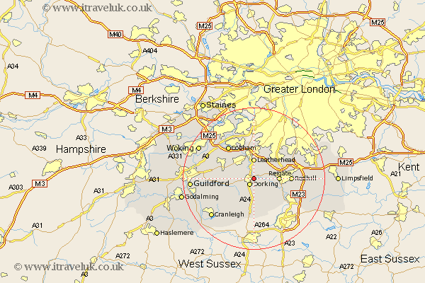
Surrey Map Showing Location of Box Hill
District: Mole Valley
Easting: 517510 Northing: 149638
Latitude: 51.23 Longitude: -0.32
 = Box Hill
Easting: 517510 Northing: 149638
Latitude: 51.23 Longitude: -0.32
= Box Hill
This Box Hill map below is supplied by Google. Use the tools in the top left corner to zoom into street level or zoom out for a road map, you may also need to zoom in to see Box Hill on the map. Click and drag the map to move around. If the map fails to load try and refresh your browser or zoom in or out (+ or -).
Update - it seems Google no longer allow people to use their maps for free! This Box Hill map sometimes loads and sometimes gives a error. I am working on a solution.
Closest 30 Towns or Cities to Box Hill (Population over 500)
Mickleham 1.86km Dorking 2.18km Westcott 2.97km Betchworth 4.64km Buckland 4.64km Leatherhead 5.56km Holmwood 5.56km Wotton 5.94km Effingham 6.09km Leigh 6.88km Reigate 6.96km Tadworth 8.03km Abinger 8.04km East Horsley 8.33km Horsley 8.33km Newdigate 9.55km Oxshott 9.56km West Horsley 10km Redhill 10.44km Shere 11.08km Salfords 11.08km Capel 11.12km Ockley 11.36km Charlwood 11.59km Church Cobham 11.59km Cobham 11.59km Albury 12.18km Horley 12.81km Ripley 12.86km West Clandon 12.9km