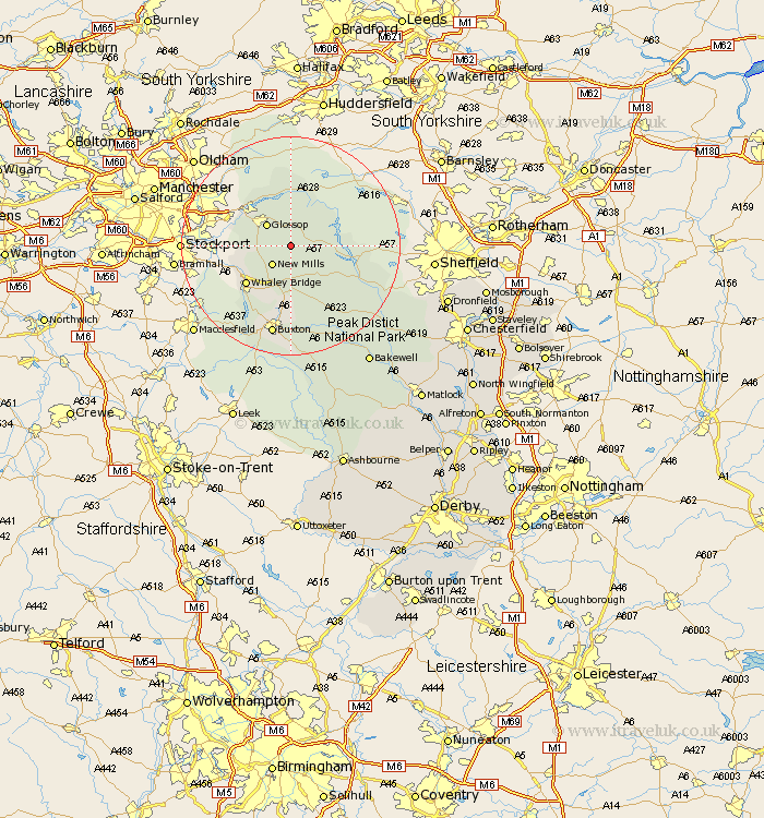
Derbyshire Map Showing Location of The Peak
District: High Peak
Easting: 408864 Northing: 389278
Latitude: 53.4 Longitude: -1.87
 = The Peak
Easting: 408864 Northing: 389278
Latitude: 53.4 Longitude: -1.87
= The Peak
This The Peak map below is supplied by Google. Use the tools in the top left corner to zoom into street level or zoom out for a road map, you may also need to zoom in to see The Peak on the map. Click and drag the map to move around. If the map fails to load try and refresh your browser or zoom in or out (+ or -).
Update - it seems Google no longer allow people to use their maps for free! This The Peak map sometimes loads and sometimes gives a error. I am working on a solution.
Closest 30 Towns or Cities to The Peak (Population over 500)
New Mills 4.97km Hayfield 5.83km Glossop 5.85km Chapel en le Frith 9.52km Hope 9.53km Charlesworth 9.58km Tintwistle 9.94km Tintwhistle 9.94km Castleton 9.95km Whaley Bridge 10.72km Bradwell 12.07km Bamford 13.37km Tideswell 16.24km Buxton 17.01km Hathersage 17.1km Eyam 18.57km Grindleford 20.21km Grindleford Bridge 20.21km Stony Middleton 20.66km Stoney Middleton 20.66km Great Longstone 21.59km Longstone 21.59km Baslow 24.89km Bakewell 25.91km Holmesfield 26.61km Middleton 27.79km Youlgreave 28.21km Dronfield 28.78km Barlow 29.45km Old Brampton 30.61km