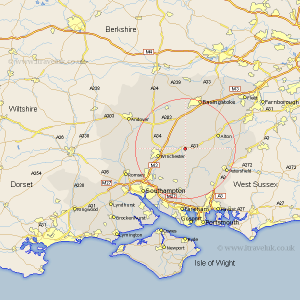
Hampshire Map Showing Location of New Alresford
Population: 5102
District: Winchester
Easting: 458363 Northing: 131942
Latitude: 51.08 Longitude: -1.17
 = New Alresford
District: Winchester
Easting: 458363 Northing: 131942
Latitude: 51.08 Longitude: -1.17
= New Alresford
This New Alresford map below is supplied by Google. Use the tools in the top left corner to zoom into street level or zoom out for a road map, you may also need to zoom in to see New Alresford on the map. Click and drag the map to move around. If the map fails to load try and refresh your browser or zoom in or out (+ or -).
Update - it seems Google no longer allow people to use their maps for free! This New Alresford map sometimes loads and sometimes gives a error. I am working on a solution.
Closest 30 Towns or Cities to New Alresford (Population over 500)
Cheriton 3.7km Ropley 6.11km Bramdean 6.57km Medstead 7.91km Micheldever 8.93km Four Marks 8.95km Kings Worthy 9.31km West Meon 9.42km Winchester 10.89km Owslebury 11.6km Wonston 12.83km Twyford 12.84km Upper Farringdon 12.94km Faringdon 12.94km Farringdon 12.94km North Waltham 13.03km Dummer 13.03km Corhampton 13.17km Upham 13.78km Compton 13.8km Froxfield 13.8km Alton 13.95km East Meon 14.51km Droxford 15km Bishops Waltham 15.23km Bishop's Waltham 15.23km Sparsholt 15.25km Otterbourne 15.81km Durley 15.93km Selborne 16.3km