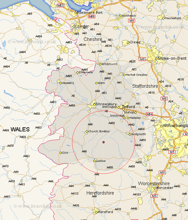
Shropshire Map Showing Location of Tugford
District: South Shropshire
Easting: 355863 Northing: 287503
Latitude: 52.48 Longitude: -2.65
 = Tugford
Easting: 355863 Northing: 287503
Latitude: 52.48 Longitude: -2.65
= Tugford
This Tugford map below is supplied by Google. Use the tools in the top left corner to zoom into street level or zoom out for a road map, you may also need to zoom in to see Tugford on the map. Click and drag the map to move around. If the map fails to load try and refresh your browser or zoom in or out (+ or -).
Update - it seems Google no longer allow people to use their maps for free! This Tugford map sometimes loads and sometimes gives a error. I am working on a solution.
Closest 30 Towns or Cities to Tugford (Population over 500)
Diddlebury 4.88km Rushbury 5.84km Ditton Priors 5.94km Bitterley 9.26km Church Stretton 12.57km Craven Arms 13.61km Wistanstow 13.67km Ludlow 14.14km Much Wenlock 14.63km Caynham 14.86km Cleobury Mortimer 15.85km Bridgnorth 16.74km Cressage 16.83km Kinlet 17.46km Barrow 17.95km Barrow Bridge 17.95km Highley 18.44km Broseley 18.63km Berrington 18.84km Condover 19.73km Lydbury North 20.4km North Lydbury 20.4km Worfield 20.56km Alveley 20.66km Ironbridge 20.78km Baystonhill 21.48km Madeley 22.2km Dawley 23.86km Bucknell 24.12km Claverley 24.33km