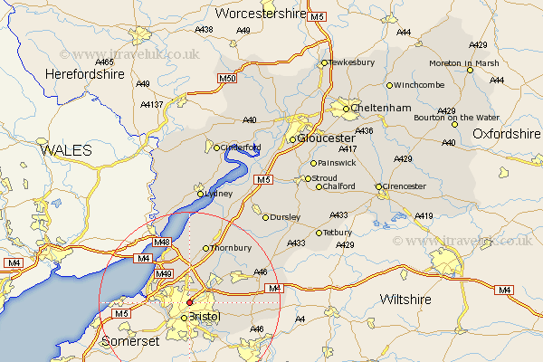
Gloucestershire Map Showing Location of Stapleton
Easting: 360655 Northing: 176244
Latitude: 51.48 Longitude: -2.57
 = Stapleton
Latitude: 51.48 Longitude: -2.57
= Stapleton
This Stapleton map below is supplied by Google. Use the tools in the top left corner to zoom into street level or zoom out for a road map, you may also need to zoom in to see Stapleton on the map. Click and drag the map to move around. If the map fails to load try and refresh your browser or zoom in or out (+ or -).
Update - it seems Google no longer allow people to use their maps for free! This Stapleton map sometimes loads and sometimes gives a error. I am working on a solution.
Closest 30 Towns or Cities to Stapleton (Population over 500)
Filton 3.71km Bristol 3.88km Stoke Gifford 3.89km Kingswood 4.97km Patchway 5.56km Mangotsfield 6.92km Almondsbury 7.42km Winterbourne 7.84km Frampton Cotterell 8.01km Siston 8.29km Pilning 8.73km Westerleigh 9.95km Wick 9.95km Iron Acton 10.14km Bitton 10.96km Olveston 11.12km Rangeworthy 12.29km Alveston 13.18km Thornbury 13.43km Aust 13.43km Chipping Sodbury 13.85km Tytherington 14.2km Wickwar 16.87km Cromhall 16.89km Charfield 18.1km Falfield 18.53km Marshfield 18.84km Tidenham 19.41km Hawkesbury 19.6km Stone 19.78km