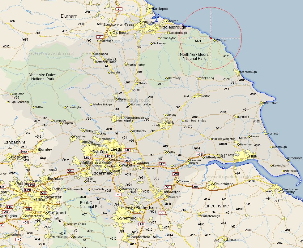
Yorkshire Map Showing Location of Sandsend
District: Scarborough
Easting: 486337 Northing: 512463
Latitude: 54.5 Longitude: -0.67
 = Sandsend
Easting: 486337 Northing: 512463
Latitude: 54.5 Longitude: -0.67
= Sandsend
This Sandsend map below is supplied by Google. Use the tools in the top left corner to zoom into street level or zoom out for a road map, you may also need to zoom in to see Sandsend on the map. Click and drag the map to move around. If the map fails to load try and refresh your browser or zoom in or out (+ or -).
Update - it seems Google no longer allow people to use their maps for free! This Sandsend map sometimes loads and sometimes gives a error. I am working on a solution.
Closest 30 Towns or Cities to Sandsend (Population over 500)
Whitby 2.76km Sleights 5.56km Hinderwell 7.44km Hawsker 8.52km Fylingdales 12.65km Loftus 15.05km Brotton 18.74km Skelton 21.18km Skelton-in-Cleveland 21.18km Saltburn 22.43km Saltburn by the Sea 22.43km Saltburn-by-the-Sea 22.43km Cloughton 23.91km Marske 24.87km Marske by the Sea 24.87km Marske-by-the-Sea 24.87km Guisborough 25.02km Burniston 25.37km Redcar 28.01km Scalby 28.44km Eston 28.51km Pickering 28.54km Scarborough 28.76km Ingleby 28.97km Thornton-le-Dale 29.83km Thornton Dale 29.83km Great Ayton 30.13km Kirby Moorside 31.16km Kirkby Moorside 31.16km Snainton 31.96km