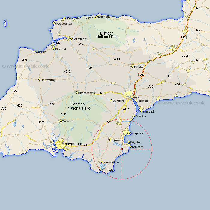
Devon Map Showing Location of Sandquay
District: South Hams
Easting: 287406 Northing: 53132
Latitude: 50.37 Longitude: -3.58
 = Sandquay
Easting: 287406 Northing: 53132
Latitude: 50.37 Longitude: -3.58
= Sandquay
This Sandquay map below is supplied by Google. Use the tools in the top left corner to zoom into street level or zoom out for a road map, you may also need to zoom in to see Sandquay on the map. Click and drag the map to move around. If the map fails to load try and refresh your browser or zoom in or out (+ or -).
Update - it seems Google no longer allow people to use their maps for free! This Sandquay map sometimes loads and sometimes gives a error. I am working on a solution.
Closest 30 Towns or Cities to Sandquay (Population over 500)
Dartmouth 1.86km Kingswear 2.2km Stoke Gabriel 4.39km Stoke Fleming 5.68km Brixham 6.19km Blackawton 6.2km Strete 6.6km Street 6.6km Paignton 7.02km Berry Pomeroy 8.79km Totnes 9.96km Harberton 10.97km Marldon 11.18km East Allington 12.01km Torquay 12.33km Stokenham 12.6km Ipplepen 13.44km Staverton 13.86km Diptford 14.66km Broadhempston 14.77km Kingskerswell 14.82km Abbotskerswell 15.01km Loddiswell 15.24km Denbury 15.56km Kingsbridge 15.98km Stokeinteignhead 17.05km Newton Abbot 18.57km Ugborough 19km South Brent 19.21km Brent 19.21km