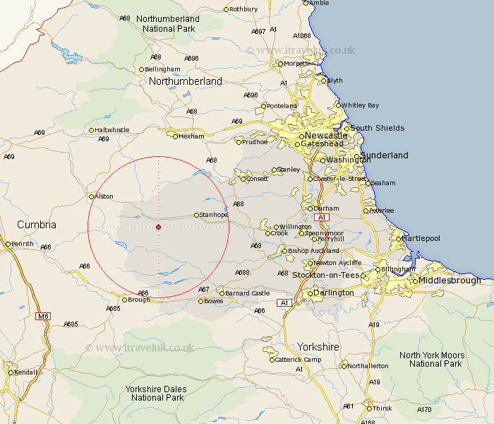
Durham Map Showing Location of Saint John Weardale
District: Wear Valley
Easting: 389264 Northing: 535768
Latitude: 54.72 Longitude: -2.17
 = Saint John Weardale
Easting: 389264 Northing: 535768
Latitude: 54.72 Longitude: -2.17
= Saint John Weardale
This Saint John Weardale map below is supplied by Google. Use the tools in the top left corner to zoom into street level or zoom out for a road map, you may also need to zoom in to see Saint John Weardale on the map. Click and drag the map to move around. If the map fails to load try and refresh your browser or zoom in or out (+ or -).
Update - it seems Google no longer allow people to use their maps for free! This Saint John Weardale map sometimes loads and sometimes gives a error. I am working on a solution.
Closest 30 Towns or Cities to Saint John Weardale (Population over 500)
Stanhope 10.32km Middleton in Teesdale 12.34km Wolsingham 18.2km Cotherstone 20.43km Tow Law 22.55km Castleside 23.2km Startforth 25.98km Barnard Castle 25.98km Consett 26.01km Consetti 26.01km Cockfield 26.07km Cornsay 26.72km Etherley 27.79km High Etherley 27.79km Crook 27.9km Evenwood 28.02km Leadgate 28.82km Staindrop 28.89km West Auckland 29.36km Lanchester 29.94km Willington 29.97km Esh 30.85km Annfield Plain 31.49km Bishop Auckland 32.98km Langley Park 33.39km Gainford 33.49km Coundon 33.67km Ushaw Moor 33.97km Stanley 34.12km Shildon 34.49km