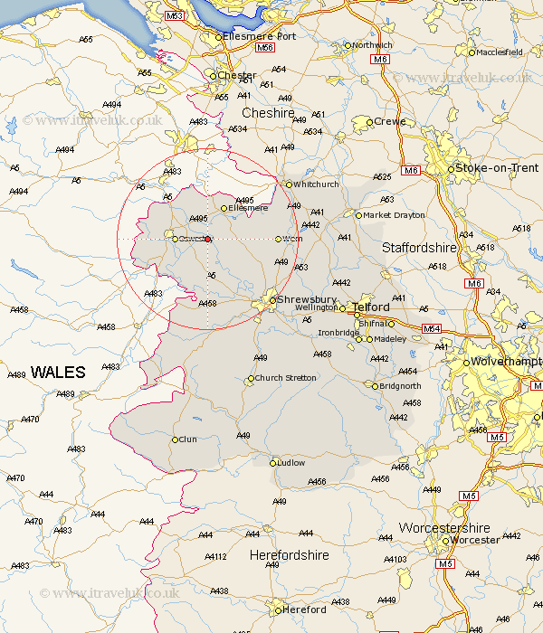
Shropshire Map Showing Location of Rednall
District: Oswestry
Easting: 337153 Northing: 328499
Latitude: 52.85 Longitude: -2.93
 = Rednall
Easting: 337153 Northing: 328499
Latitude: 52.85 Longitude: -2.93
= Rednall
This Rednall map below is supplied by Google. Use the tools in the top left corner to zoom into street level or zoom out for a road map, you may also need to zoom in to see Rednall on the map. Click and drag the map to move around. If the map fails to load try and refresh your browser or zoom in or out (+ or -).
Update - it seems Google no longer allow people to use their maps for free! This Rednall map sometimes loads and sometimes gives a error. I am working on a solution.
Closest 30 Towns or Cities to Rednall (Population over 500)
Whittington 4.85km West Felton 5km Cockshut 5.6km Cockshutt 5.6km Oswestry 6.71km St Martins 7.29km St. Martins 7.29km Saint Martins 7.29km Gobowen 7.67km Welshampton 7.89km Ellesmere 8.14km Kinnerley 8.14km Baschurch 8.66km Great Ness 9.53km Loppington 10.24km Selattyn 11.5km Pant 11.63km Wem 14.55km Alberbury 14.86km Bicton 15.16km Llanyblodwel 15.35km Whixall 15.57km Ford 15.85km Hadnall 17.26km Prees 18.28km Precs 18.28km Westbury 18.57km Stanton upon Hine Heath 19.39km Stanton 19.39km Shrewsbury 20.02km