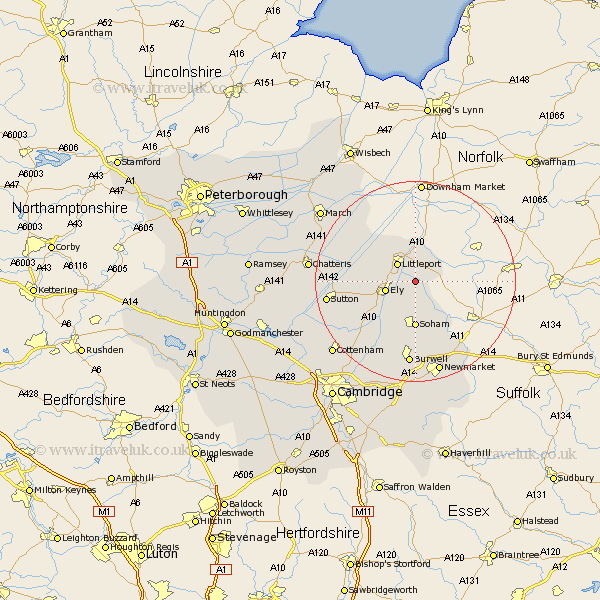
Cambridgeshire Map Showing Location of Prickwillow
District: East Cambridgeshire
Easting: 559799 Northing: 282495
Latitude: 52.42 Longitude: 0.35
 = Prickwillow
Easting: 559799 Northing: 282495
Latitude: 52.42 Longitude: 0.35
= Prickwillow
This Prickwillow map below is supplied by Google. Use the tools in the top left corner to zoom into street level or zoom out for a road map, you may also need to zoom in to see Prickwillow on the map. Click and drag the map to move around. If the map fails to load try and refresh your browser or zoom in or out (+ or -).
Update - it seems Google no longer allow people to use their maps for free! This Prickwillow map sometimes loads and sometimes gives a error. I am working on a solution.
Closest 30 Towns or Cities to Prickwillow (Population over 500)
Littleport 5.02km Ely 5.95km Downham 7.03km Soham 9.27km Isleham 10.32km Stretham 10.62km Witchford 10.83km Wicken 13.41km Fordham 13.41km Manea 13.51km Chippenham 14.16km Wilburton 14.49km Haddenham 15.47km Mepal 15.94km Burwell 16.72km Sutton 17.36km Swaffham Prior 18.84km Doddington 20.58km Chatteris 20.67km Swaffham Bulbeck 20.89km Wimblington 21.31km Cottenham 21.7km Waterbeach 21.72km Willingham 22.22km Bottisham 22.95km Colne 23.29km March 23.36km Cheveley 23.61km Earith 23.81km Bluntisham 23.81km