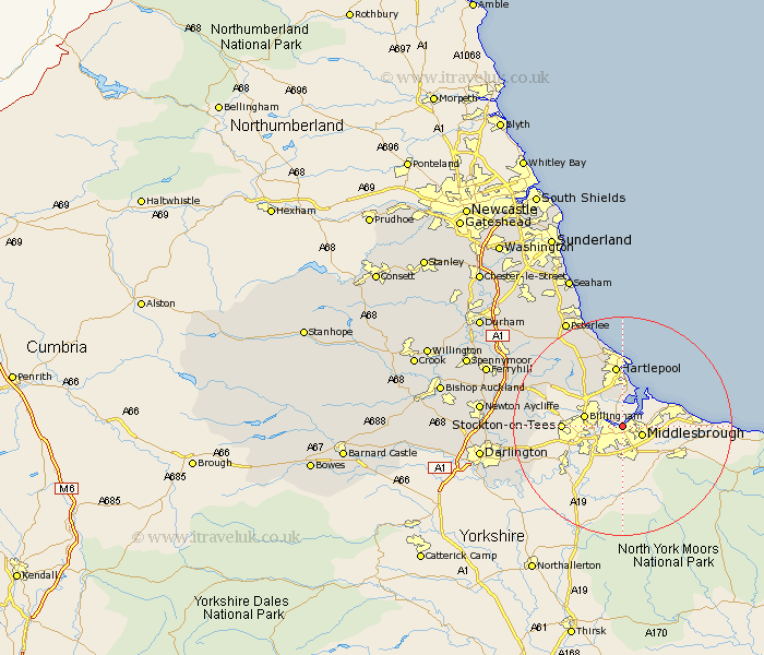
Durham Map Showing Location of Port Clarence
Easting: 451698 Northing: 521207
Latitude: 54.58 Longitude: -1.2
 = Port Clarence
Latitude: 54.58 Longitude: -1.2
= Port Clarence
This Port Clarence map below is supplied by Google. Use the tools in the top left corner to zoom into street level or zoom out for a road map, you may also need to zoom in to see Port Clarence on the map. Click and drag the map to move around. If the map fails to load try and refresh your browser or zoom in or out (+ or -).
Update - it seems Google no longer allow people to use their maps for free! This Port Clarence map sometimes loads and sometimes gives a error. I am working on a solution.
Closest 30 Towns or Cities to Port Clarence (Population over 500)
Greatham 5.96km Wolviston 6.53km Billingham on Tees 6.71km Billingham 6.71km Billingham-on-Tees 6.71km Thornaby-on-Tees 8.51km Thornaby 8.51km Thornaby on Tees 8.51km Stockton 10.1km Stockton on Tees 10.1km Stockton-on-Tees 10.1km Eaglescliffe 11.15km Hartlepool 11.17km Egglescliffe 12.19km Elwick 12.35km Grindon 12.38km Carlton 12.89km Yarm-on-Tees 13.4km Yarm on Tees 13.4km Yarm 13.4km Stillington 15.15km Hart 15.44km Sedgefield 16.76km Hutton Henry 17.7km Fishburn 18.69km Trimdon 19.05km Horden 19.3km Hesleden 20km Wingate 20.43km Bishop Middleham 21.36km