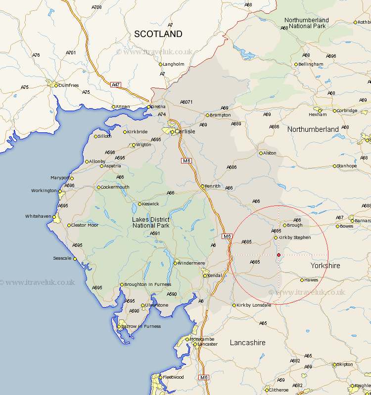
Cumbria Map Showing Location of Outhgill
District: Eden
Easting: 378362 Northing: 500570
Latitude: 54.4 Longitude: -2.33
 = Outhgill
Easting: 378362 Northing: 500570
Latitude: 54.4 Longitude: -2.33
= Outhgill
This Outhgill map below is supplied by Google. Use the tools in the top left corner to zoom into street level or zoom out for a road map, you may also need to zoom in to see Outhgill on the map. Click and drag the map to move around. If the map fails to load try and refresh your browser or zoom in or out (+ or -).
Update - it seems Google no longer allow people to use their maps for free! This Outhgill map sometimes loads and sometimes gives a error. I am working on a solution.
Closest 30 Towns or Cities to Outhgill (Population over 500)
Ravenstonedale 5.7km Kirkby Stephen 7.49km Brough 13.15km Sedbergh 15.06km Millthrop 15.06km Milnthorpe 15.06km Tebay 16.29km Dent 16.64km Orton 16.81km Crosby Ravensworth 20.72km Appleby 20.91km Shap 25.15km Long Marston 25.19km Long Marton 25.19km Kirkby Londsdale 27.53km Kirkby Lonsdale 27.53km Kirkby Thore 27.86km Kendall 28.54km Kendal 28.54km Natland 28.99km Staveley 31.52km Culgaith 32.69km Levens 33.61km Heversham 33.67km Holme 34.63km Milnthorpe 34.73km Beetham 35.85km Windermere 37.96km Langwathby 38.14km Dacre 40.28km