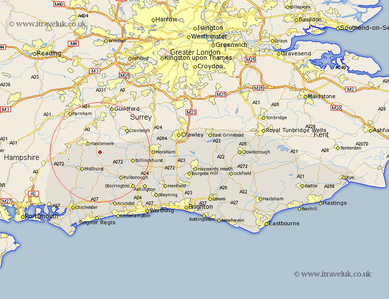
Sussex Map Showing Location of Northchapel
Population: 813
District: Chichester
Easting: 495784 Northing: 128798
Latitude: 51.05 Longitude: -0.63
 = Northchapel
District: Chichester
Easting: 495784 Northing: 128798
Latitude: 51.05 Longitude: -0.63
= Northchapel
This Northchapel map below is supplied by Google. Use the tools in the top left corner to zoom into street level or zoom out for a road map, you may also need to zoom in to see Northchapel on the map. Click and drag the map to move around. If the map fails to load try and refresh your browser or zoom in or out (+ or -).
Update - it seems Google no longer allow people to use their maps for free! This Northchapel map sometimes loads and sometimes gives a error. I am working on a solution.
Closest 30 Towns or Cities to Northchapel (Population over 500)
Lurgashall 4.38km Plaistow 4.66km Fernhurst 6.12km Kirdford 6.9km Tillington 7.51km Petworth 7.78km Linchmere 8.16km Loxwood 8.36km Wisborough Green 10.03km Midhurst 10.19km Fittleworth 12.06km Iping 12.85km Billingshurst 13.34km Graffham 13.44km Pulborough 13.8km Coldwaltham 14.74km Rudgwick 15.04km Rogate 15.05km Slinfold 16.31km Amberley 16.39km Bury 17.32km Itchingfield 17.58km West Chillington 18.25km West Chiltington 18.25km East Harting 18.77km Storrington 19.5km Thakeham 19.96km Southwater 20.16km Shipley 20.83km Horsham 20.97km