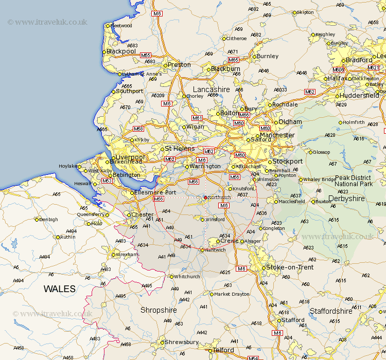
Cheshire Map Showing Location of Northwich
Population: 33879
Area Size (ha): 1091
District: Vale Royal
Easting: 366655 Northing: 374559
Latitude: 53.27 Longitude: -2.5
 = Northwich
Area Size (ha): 1091
District: Vale Royal
Easting: 366655 Northing: 374559
Latitude: 53.27 Longitude: -2.5
= Northwich
This Northwich map below is supplied by Google. Use the tools in the top left corner to zoom into street level or zoom out for a road map, you may also need to zoom in to see Northwich on the map. Click and drag the map to move around. If the map fails to load try and refresh your browser or zoom in or out (+ or -).
Update - it seems Google no longer allow people to use their maps for free! This Northwich map sometimes loads and sometimes gives a error. I am working on a solution.
Closest 30 Towns or Cities to Northwich (Population over 500)
Lostock Gralam 2.22km Anderton 2.22km Davenham 3.88km Hartford 4.99km Plumbley 5.54km Plumley Station 5.54km Weaverham 5.85km Whitegate 6.48km Acton 6.65km Cuddington 7.62km Stretton 8.63km Mere 9.25km Winsford 9.34km Knutsford 9.61km Appleton 9.84km High Legh 9.84km Peover Superior 10.15km Peover 10.15km Middlewich 10.28km Middlewick 10.28km Kingsley 11.08km Preston Brook 11.42km Preston on the Hill 11.42km Preston-on-the-Hill 11.42km Little Budworth 11.42km Holmes Chapel 11.57km Goostrey 11.69km Lymm 11.97km Delamere 12.41km Thelwall 13.01km