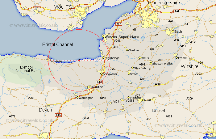
Somerset Map Showing Location of Little Stoke
District: West Somerset
Easting: 316168 Northing: 145273
Latitude: 51.2 Longitude: -3.2
 = Little Stoke
Easting: 316168 Northing: 145273
Latitude: 51.2 Longitude: -3.2
= Little Stoke
This Little Stoke map below is supplied by Google. Use the tools in the top left corner to zoom into street level or zoom out for a road map, you may also need to zoom in to see Little Stoke on the map. Click and drag the map to move around. If the map fails to load try and refresh your browser or zoom in or out (+ or -).
Update - it seems Google no longer allow people to use their maps for free! This Little Stoke map sometimes loads and sometimes gives a error. I am working on a solution.
Closest 30 Towns or Cities to Little Stoke (Population over 500)
Stogursey 5km Stokscourey 5km Stoke Courcy 5km Nether Stowey 6.03km Otterhampton 8.34km Watchet 10km Stogumber 10.18km Spaxton 10.93km Williton 13.79km Durleigh 13.97km Pawlett 14.06km Burnham-on-Sea 14.41km Burnham 14.41km Burnham on Sea 14.41km Berrow 14.76km Bishops Lydeard 14.87km Huntspill 15.1km Highbridge 15.21km Carhampton 15.21km Brean 15.77km Kingston 15.92km Puriton 16.68km Bridgewater 16.74km Bridgwater 16.74km North Petherton 16.95km Brent Knoll 17.17km Norton Fitzwarren 18.86km Taunton 19.43km West Monkton 19.69km Lympsham 19.71km