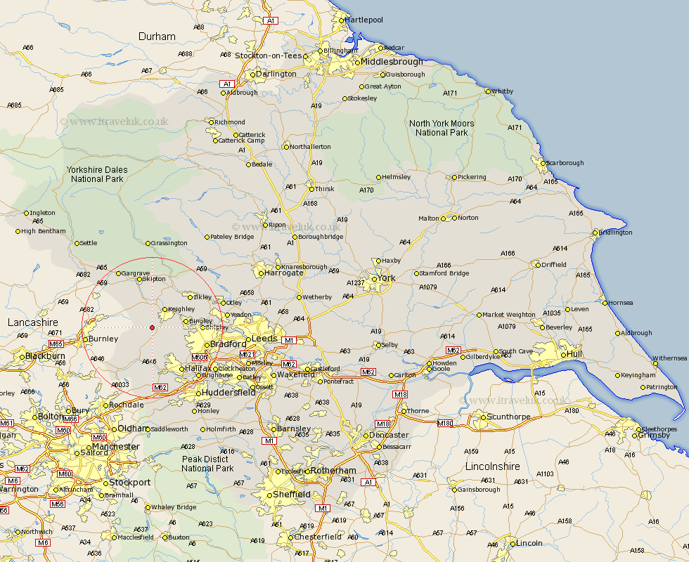
Yorkshire Map Showing Location of Oakworth
District: Bradford
Easting: 402193 Northing: 437472
Latitude: 53.83 Longitude: -1.97
 = Oakworth
Easting: 402193 Northing: 437472
Latitude: 53.83 Longitude: -1.97
= Oakworth
This Oakworth map below is supplied by Google. Use the tools in the top left corner to zoom into street level or zoom out for a road map, you may also need to zoom in to see Oakworth on the map. Click and drag the map to move around. If the map fails to load try and refresh your browser or zoom in or out (+ or -).
Update - it seems Google no longer allow people to use their maps for free! This Oakworth map sometimes loads and sometimes gives a error. I am working on a solution.
Closest 30 Towns or Cities to Oakworth (Population over 500)
Haworth 2.15km Oxenhope 3.86km Cullingworth 4.75km Sutton-in-Craven 5.67km Steeton 5.67km Keighley 6.46km Wilsden 6.82km Denholme 7.08km Glusburn 7.73km Silsden 7.73km Queensbury 8.1km Bingley 8.94km Heptonstall 9.83km Hebden Bridge 9.83km Cononley 9.84km Carleton 12.39km Carlton 12.39km Addingham 12.39km Mytholmroyd 13.01km Shipley 13.12km Luddenden Foot 13.15km Baildon 13.25km Earby 13.52km Ilkley 13.52km Embsay 14.87km Todmorden 15.06km Halifax 15.06km Skipton 15.19km Bradford 15.27km Menston 16.28km