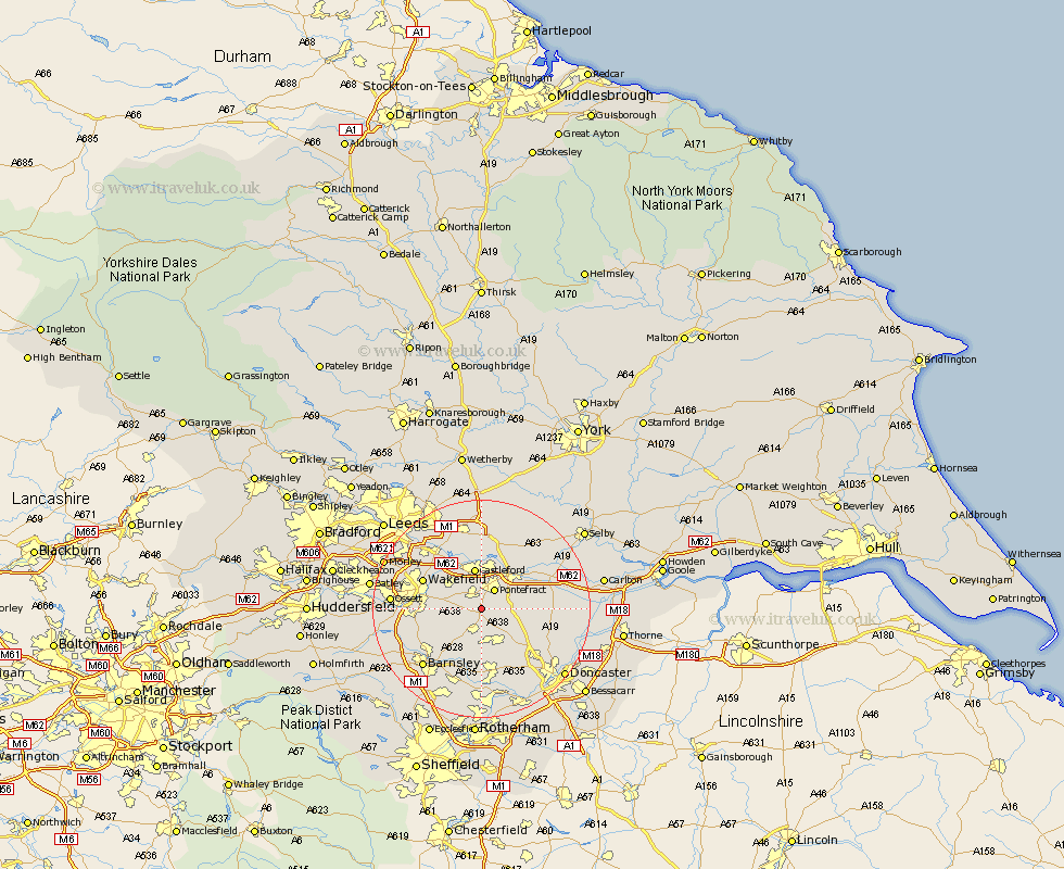
Yorkshire Map Showing Location of Ackworth
Population: 5917
Area Size (ha): 148
District: Wakefield
Easting: 444061 Northing: 417287
Latitude: 53.65 Longitude: -1.33
 = Ackworth
Area Size (ha): 148
District: Wakefield
Easting: 444061 Northing: 417287
Latitude: 53.65 Longitude: -1.33
= Ackworth
This Ackworth map below is supplied by Google. Use the tools in the top left corner to zoom into street level or zoom out for a road map, you may also need to zoom in to see Ackworth on the map. Click and drag the map to move around. If the map fails to load try and refresh your browser or zoom in or out (+ or -).
Update - it seems Google no longer allow people to use their maps for free! This Ackworth map sometimes loads and sometimes gives a error. I am working on a solution.
Closest 30 Towns or Cities to Ackworth (Population over 500)
Fitzwilliam 3.78km Pontefract 4.31km Badsworth 4.31km Upton 4.96km Crofton 5.49km Hemsworth 5.67km Darrington 5.8km Featherstone 5.98km North Elmsall 6.62km Castleford 7.5km Ryhill 7.56km Moorthorpe 7.74km Normanton 7.81km South Kirkby 7.85km South Elmsall 8.12km Brotherton 8.62km Knottingly 8.62km Knottingley 8.62km Shafton 9.23km Royston 9.49km Norton 10.06km Campsall 10.56km Cudworth 10.77km Great Houghton 11.17km Houghton 11.17km Little Houghton 11.34km Stanley 11.34km Wakefield 11.34km Notton 11.35km Brodsworth 11.96km